Package cost: $1700 (Inclusive of meals, accommodation, and gas and park entry fees.) Excludes tips, drinks and donations).
When in groups, a special discount on the total tour cost will be given as follows:
A group of two, three and four- 10% discount
A group of more than 5- 15% discount
Itinerary
Your arrival at the Procmura building Nairobi will be the first thing for this tour to complete paperwork and ensure you are ready to ride. Our guides will give out a few instructions and advice on how to successfully take part in the tour. You will ensure that your bike is good to go, with possible adjustments where necessary.
From our offices, we will head to Rongai via Uhuru Highway, and then Lang’ata road. Being busy roads, caution is thereby required from every rider. From Lang’ata, we will take Magadi road to Rongai, one of the towns found in Kajiado County. Riding on Magadi road will give you a glimpse about the terrain you’ll be about to undertake. Raving the motorcycle up the steep slopes and climbs at moderate speeds will jog your adventure personality and make you ready for endless fun.
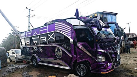
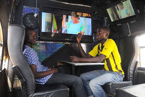
Ongata Rongai town is situated east of Ngong Hills, and on a clear day, you may be able to spot the mountains from a distant. The town is famous for its Passenger service vehicles that are pimped with style. Locals call them “Nganya” meaning a pimped matatus. The matatus culture entails mini buses with graffiti painting, television sets mounted in the buses, which in most times play loud music while ferrying the passengers.
The town which was initially occupied by the Maasai people is undergoing rapid development. The presence of Multimedia University has increased has increased the need for products and services, which has in turn pulled in investors.
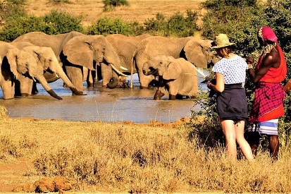
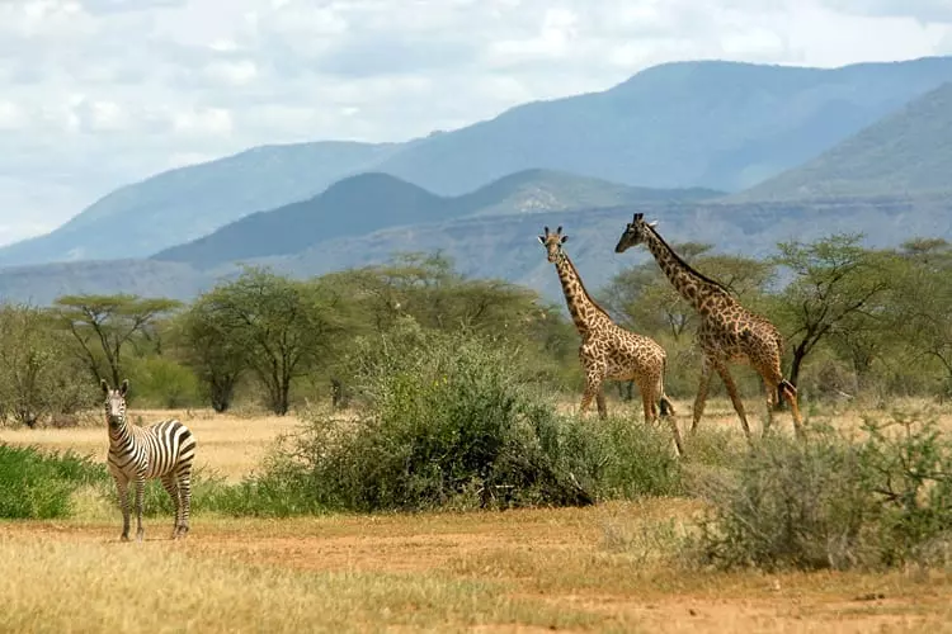
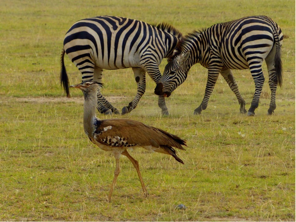
After a quick stop in Ongata Rongai, we will ride to the Rimpa Estate Wildlife Conservancy. You’ll be able to see different animals including giraffes, zebras, gazelles, elephants and a number of plant species. Additionally, you will also understand the efforts put in place by the conservancy to ensuring a viable ecosystem.
From the Rimpa Estate wildlife Conservancy, we will continue on Magadi Road to Kiserian, another town in Kajiado County. It is located on the boundary between Kajiado North and Kajiado West constituencies.
It lies at the foot of the Ngong Hills, along Magadi Road just adjacent to the Kiserian dam.
The spectacular views of Ngong hills and the rift valley from Kiserian are amazing, and will easily make you fall in love. Kiserian town is known for providing a good market for the Maasai community, due to its centrality within the county.
Before proceeding, we will pass by the Lesiolo Hill hotel, one of the best hotel in the area, where we will grab a quick bite before proceeding with our adventure. You’ll have options of different food to choose from. You can also decide to try some of the local food, common amongst the Maasai people.
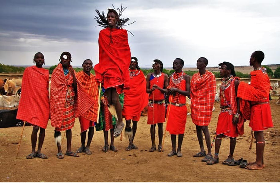
After a delicious meal, we will ride our bikes to Maasai village, referred by the locals as “Manyattas”. This is one of the African community with a special culture, worthy knowing and understanding.
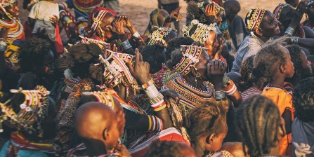
It is arguably the most iconic cultures in East and Central Africa. Their nomadic lifestyle is arguably the least touched with the western civilization, since they still retain most of their traditions, the likes of their attire style.
While in the village, you may be required to give a small donation to the residents. Additionally, the residents may also want you to buy some handmade crafts and souvenirs. For some this can be an unpleasant part of the excursion though in totality we feel this is a minor negative that has become a part of the experience and the positive part of the visit outweighs the negative.
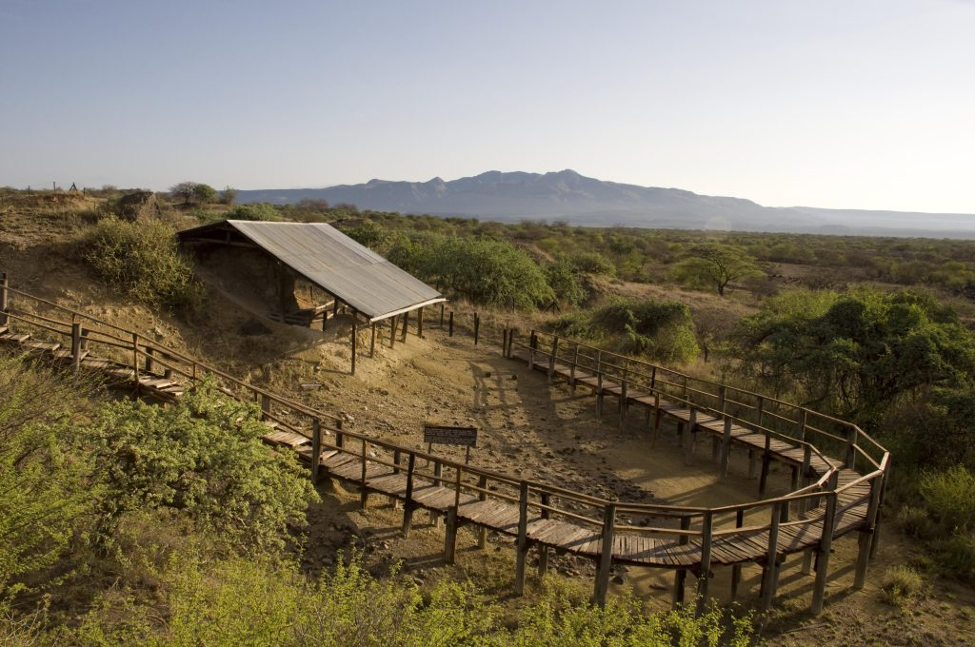
From the Maasai village, our next stop will be at Olorgesailie Prehistoric site. It is world renown as the “factory of stone tools” and the only place in the world with such a large number. This Acheulian site is located about 90kms South-West of Nairobi on Magadi Road. It is characterized by in-situ displays of prehistoric materials including numerous hand axes, fossilized skeletons of extinct species of elephants and hippopotamus dating back from 1.2 million years ago. Other attractions include a camp site, bandas and nature trail. The prominence and accumulation of human tools represents actual camping places of early men and evidence that human species had a tropical origin.
The site is in a lake basin that existed about 100,000 to 200,000 years ago. Olorgesailie has excellently preserved biological and cultural evidence about the evolution of man. This was made possible by heavy falls of alkaline volcanic ash from the nearby Mt. Suswa and Mt. Longonot, which might have contributed much to the accumulated ash in the lake basin. There is evidence of humid climate during part of the Middle Pleistocene that is given by temporary lakes and swamps that exist in the area today.
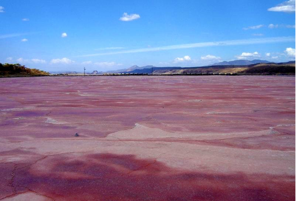
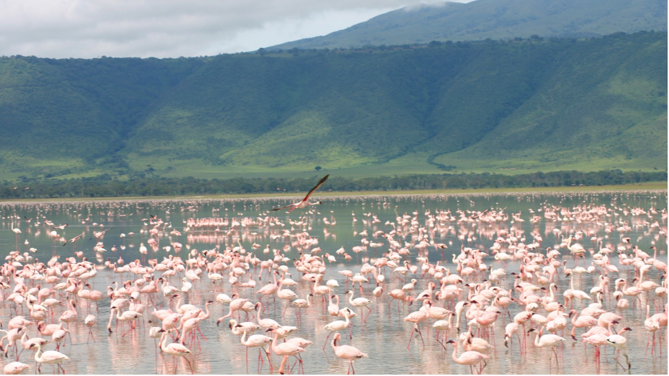
After a short prehistoric moment, we will continue riding south to Lake Magadi, one of the salty Lakes in Kenya. It is the Southernmost Kenyan Rift Valley Lake, lying in a catchment of faulted volcanic rocks, north of Tanzania’s Lake Natron. During the dry season, it is 80% covered by soda and is well known for its wading birds. The lake is enclosed by the Aberdares, Loita Hills and Mau Escarpment, it contains the most concentrated brine in the Kenyan Lake system. At times this salty lake turns bright pink due to algae bloom. In the heat of summer the temperatures reach 40 degrees and the area is desert like desolate.
Sandy outcrops are home to Maasai families and their goats. Vegetation is sparse and fresh drinking water a rarity. The flat fawn colored rocks stretch out to the horizon, broken only by the Ngurumani escarpment a moonscape not of this world. As the rains come the lake refills and the bird life always numerous explodes: Flamingo, Pelican, plover, sunbirds, finch and a myriad others. There are larger animals within the conservancy: Giraffe, Zebra, Oryx and Wildebeest and on occasion lion and elephant. But this isn’t a place for viewing animals this is a place to gaze in wonder at the scenery, to draw breath in Kenya’s raw nature, and to marvel at the resilience of the life that exists here.
The road to Magadi gives you the opportunity to glimpse inside the lives of one of the more famed Kenyan tribes, the Maasai. Peppered along the route are Maasai Villages, not tourist mimicry but real people living real lives. The journey to Magadi is a chance to see Kenyan people still living the way their forefathers did. Life appears to have remained the same for centuries. Traditionally dressed villagers tend cows and babies, or in a nod to modern times wait at the roadside for boda bodas to bring cartons of water. We will check out the flamingos, which are mostly present at the lake.
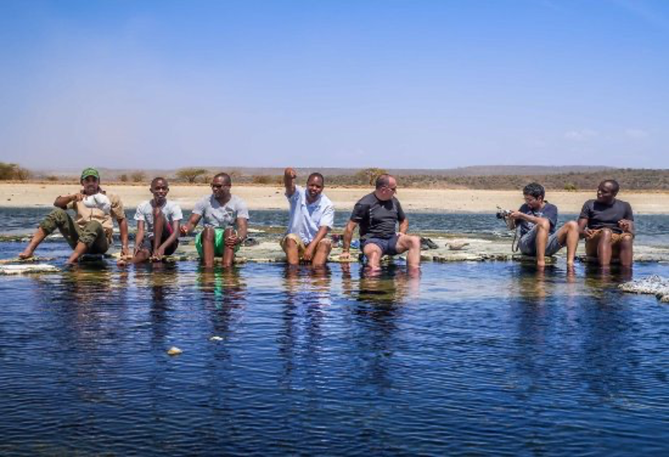
After the first and interaction with the flamingos, the famous Magadi hot springs will be our next stop. Lake Magadi hot springs are one of the natural hot springs in Kenya. They are entirely natural, but unlike the swimming pool at Olkaria Naivasha, the temperatures are quite similar to that of a normal pool. At points the springs are little more than a hole in the ground full of extremely hot water. A dip in these springs is always best at the coolest time of the day. Just like the Maasai village, there are a group of local Maasai ladies who visit the springs to sells their crafts, a nice token to bring some money and buy some of their handiwork. Due to the extreme temperatures, you’ll have to carry lots of water to keep you hydrated. You will have the opportunity to enjoy a birth in the hot springs, which the locals believe that it has healing powers, and can rid anyone of all skin diseases.
Afterwards, we will jump onto our bikes and head south to Shompole Conservancy. Shompole Conservancy is a stunning destination in between Maasai Mara National Reserve and Amboseli National Park. A place where few visitors go but it feels like you are literally the only guests in the whole ecosystem. The Great Rift Valley wall borders to the western side while to the east the Shompole wetlands and further east is Lake Magadi. This area is owned by the Maasai and they have set aside a conservancy that acts like a grass bank for the dry season for their cattle. However there is plenty of wildlife in the area and it is well known for its night game drives.
There is over 450 species of birds due to a wide variety of habitats you get in the area. There are highlands, open plains, Acacia woodland, wetlands, riverine and the soda lakes. It is hot and dry and can get dusty, but that is what safari is all about. Temperatures range from 18 to 37 (degrees Celsius) at times of the year. The conservation and research in the area is done by an incredible organization SORALO. They do a lot of different types of research and pay for all the scouts that patrol and look after all the wildlife and people. A quick stop here will allow you to see some of these animals including baboons, giraffes and vegetation, which make up the ecosystem.
The views of the Great Rift Valley walls from the conservancy are stunning, as they can be seen from a distance. These sights make photography one of the activities that are a tourist attraction in the area.
After a short stop at the Conservancy, we will head south to Lake Natron, which is at the Kenya-Tanzania border. Lake Natron is a mineral-rich soda lake in northern Tanzania, at the border with Kenya. It’s a breeding ground for hundreds of thousands of lesser flamingos, despite the highly alkaline state of the striking red waters. It sits below Ol Doinyo Lengai, a soaring active volcano in the Rift Valley. Trails lead from the lake to the Engero Sero waterfalls, which flow over craggy rocks into a natural pool. The details about this surreal lake can be extremely scary. Over a period of time, this lake has become a center of attraction for experts and analysts. The crimson water looks beautiful but not enticing enough to force people to dive and take a dip in it.
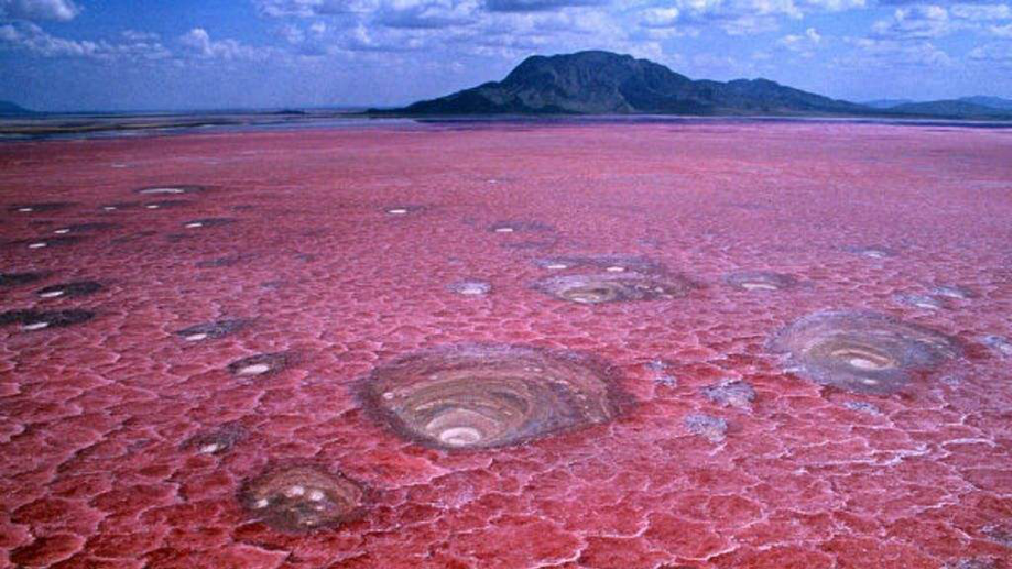
The lake contains salt, soda, and magnesite deposits. Ol Doinyo Lengai, also known as the Mountain of God, contributes to the lake’s hostile conditions. It is the only active volcano to emit natrocarbonatites – a rare carbonatite lava. Sodium carbonate and other minerals that enter the lake from the surrounding hills make the water alkaline. For the unversed, the deposits of sodium carbonate were apparently once used in the process of Egyptian mummification also. The lake, deemed one of the world’s deadliest, must be terrifying for most animals, but not for flamingoes. This lake is a thriving place and the only regular breeding area in East Africa for the 2.5 million lesser flamingoes. The salty water in Lake Natron has a pH of over 10.5 and reports said that the water is so caustic that it can burn the skin and eyes of animals that aren’t adapted to it. The lake gets its blood-red tone from Bacteria, which can tolerate harsh conditions. From the lake shores, you will have great views of the majestic mountains that occur between the Kenya-Tanzania borders. Key mountains here include Mount Ol Doinyo Lengai (a recently active Volcano), Mount Ol Doinyo Gelai and Mount Shompole.

After the great views of Lake Natron, we will head back to Lesiolo Hill Hotel via Magadi road, the same way we went, where we will spend the night. Unavailability of Hotels in Magadi town makes it a challenge to even camp, since the area is a private property under Tata Company.
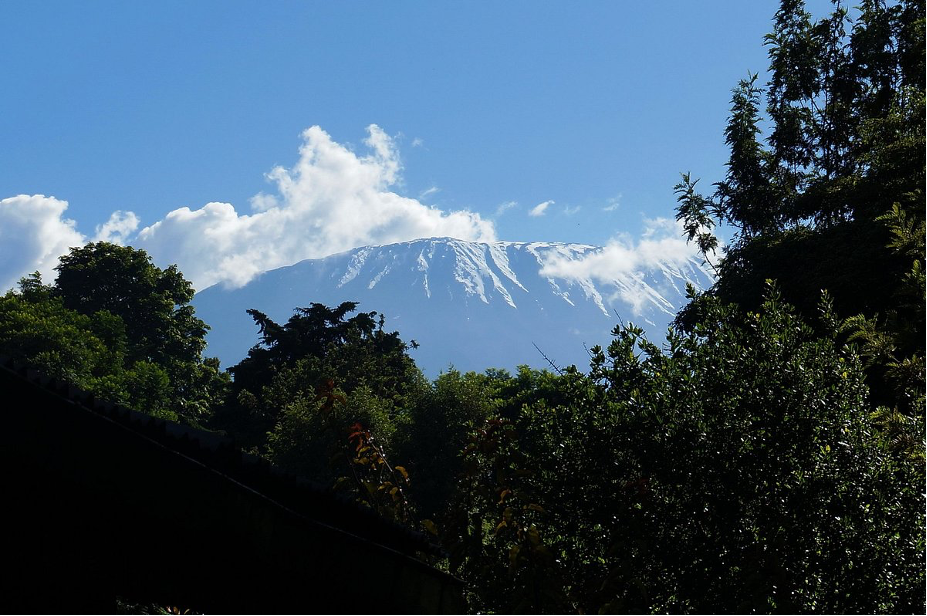
Afterwards, we will proceed to Namanga, through Isinya and Kajiado towns. Namanga is located east of Lake Natron on the Kenya Tanzania boarder. Namanga is a town divided by the Tanzania-Kenya border. It is in Longido District, Tanzania and Kajiado County, Kenya. It is around 110 kilometers from Arusha, Tanzania. Namanga’s economy has been heavily dependent on tourism since 2004 as tourists visiting the nearby Amboseli National Park passed through the town from Nairobi (183 kilometers to the north). The town is surrounded by hills on both sides. Mount Kilimanjaro can be viewed from Namanga town which makes it a scenic place by tourists who lodge in Namanga on their way to either Tanzania or Amboseli.
The nearby Ol Doinyo Orok Mountain, also known as Namanga Hills is located northwest of Namanga town. You will also be able to spot Mount Kilimanjaro from Namanga town. After amazing views, we will head to Namanga River Hotel and restaurant and get something to eat, before proceeding to Oloitoktok. The hotel has a variety of dishes that you are free to select from, depending on your taste.
After lunch, we will again jump on our bikes and head east, to Lake Amboseli. It is a lake in southern Kenya near the border with Tanzania, and a part of Amboseli national park. Most of the lake is inside Amboseli National Park, although the southwestern end is outside park boundaries.
The lake is usually bone dry, except after extended rains, whose waters fill it. We will ride down the park, which will give you an opportunity to spot some animals as we pass through.
Having had a thrilling experience in Amboseli, riding through the park and a view of the lake, our next stop will be at Loitoktok (Oloitoktok), one of the Kenyan border towns to Tanzania where we will spent the night. Loitoktok is small but growing town in southeastern Kenya, at the border with Tanzania.
The town was previously the administrative headquarters of the former Loitoktok District in which it was located. Being close to the border and hosting one of the border posts makes the town an essential destination for tourists from both Tanzania and Kenya.
After a rest for the night, we will have breakfast together as we go through the day’s activities. In the morning, a view of Mount Kilimanjaro from the resort is clear. You may therefore like to sip your cup of tea, while looking at the peak of the highest mountain on the African continent.
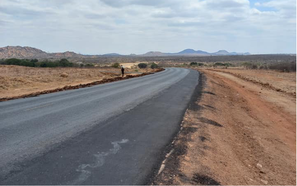
After breakfast, we will hop on our bikes and ride east, to Taveta. The road to Taveta passes through villages, with large farmlands. Due to the fertility of the soil in this region, agriculture is largely practiced, both a subsistence and commercial activity. We will be riding on a dirt road, which may pause a challenge. However, the bikes are made to endure such terrain, hence nothing to worry about. Some of the hardships on the road include steep climbs, sharp stones, sand patches, sharp corners and crossing livestock.
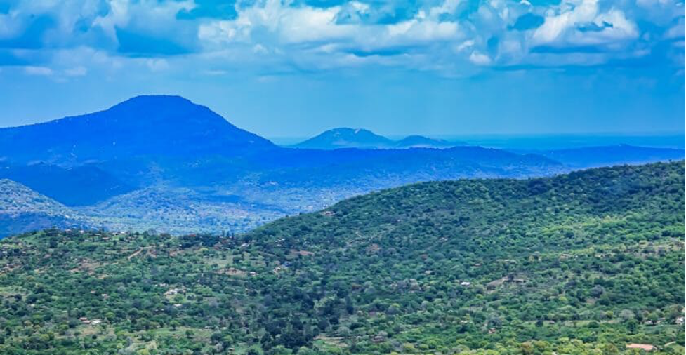
While riding, you will be able to spot the Taita Taveta hills from a distance. They are a mountain range located in the Taita-Taveta County in south-eastern Kenya. The hills consist of three massifs: Dawida, Sagalla in the southern side of Voi Township and Kasigau in the south near the border of Tanzania.
We will take a detour to Lake Chala, one lake shared by Kenya and Tanzania. The boundary is believed to divide the lake into approximately two halves. It is a crater lake in a caldera at the border between Tanzania and Kenya. Lake Chala was measured at a depth of 95 meters, which makes it deeper than famous Lake Victoria. Filled and drained by underground waters, the lake ranges in color from deep blue to turquoise and green.
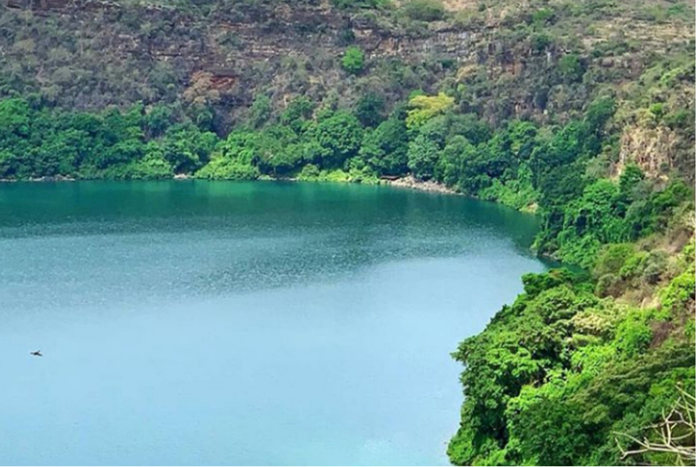
The lake is believed to have formed approximately 250,000 years ago. The lake is east of Mount Kilimanjaro, 8 kilometers north of Taveta, Kenya
Still in the spirit of looking at water bodies, we will ride to Lake Jipe, which is East of Taveta for some great views as well. It is also an inter-territorial lake straddling the borders of Kenya and Tanzania and it is said to be the mirror of Mount Kilimanjaro. It is a shallow lake, approximately 28 square kilometers and average depth less than 3 meters. Lake Jipe receives its main inflow from Mt Kilimanjaro in Tanzania via River Lumi passing through Kenya. The other main inflow is via River Muvulani from the Pare Mountains. Several temporary streams, mainly from the Pare Mountains, also drain into Lake Jipe. The lake has one outflow, the River Ruvu, located in Tanzania to the south of River Lumi, the main inflow.
From Lake Jipe, we will ride back to Taveta, where we will have our lunch at Market view Hotel, relax a little bit, before proceeding to Voi. From Taveta all the way to Voi is a smooth tarmac road, passing through Tsavo West national Park.
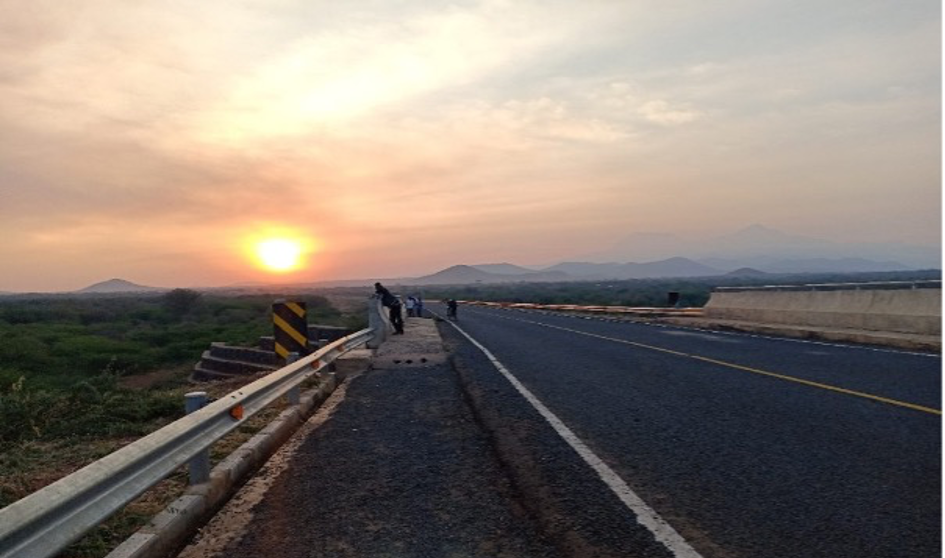
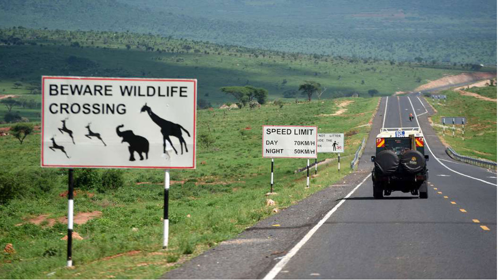
Riding here is always amazing. The smooth road, and the evening views of the sunset in the unending horizons are breath taking. You’ll have a the opportunity to see animals like giraffes, gazelles, zebras, elephants and wild beasts in Tsavo west national park, as they would have started leaving their hiding places to enjoy the cool evening in the open.
We will head straight to Afrika lodges where we will spend the night. You will need a warm birth after the long ride, before treating yourself with a nice meal and a clean place to lay down. The food here is great, combining both local and foreign tastes. So whatever you like, you are catered for!
A good breakfast is always advocated. That’s what we will start with, considering Afrika lodges offers a buffet breakfast. You will choose from the long list of available options on the menu being offered by the hotel. After ensuring our bikes, and gears are okay, we will head to Samburu via Nairobi Mombasa highway. This road, together with its sister road, Nairobi–Malaba Road, is part of the Great North Road, that links the Kenyan coast to the land-locked countries of Burundi, Eastern DR Congo, Rwanda, Uganda and South Sudan. The road moves more than 50 percent of all goods traded in the East African Community.
NOTE: You are advised to stock enough water and snacks because the stretch does not have evenly distributed hotels and restaurants, where we can have lunch. We will therefore depend on our packed dry foods and fluids as we ride along.
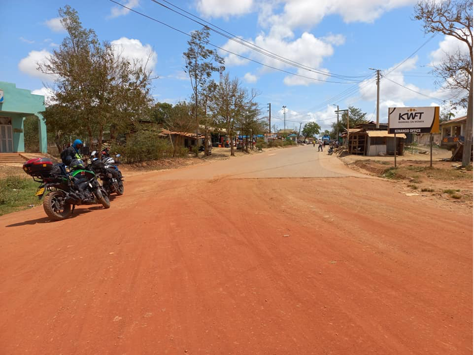
We will ride on the road for approximately 100 kilometers before branching off to Kinango. Passing through villages on winding roads, slithering through the beautiful landscape will be a good way to start off your day. The traditional Swahili lifestyle depicted by the coastal people will get your attention from different elements, including the building style.
Kinango is a small center in Kinango Constituency in Kwale County. It is one of the busy hubs in Kwale County, acting as a very important transportation node. Traffic, especially tourists from Voi to Shimba hills pass through here, pushing for its growth over time. Kinango is majorly inhabited by the Duruma and Digo clans, who have lived here for more than a century. However, a considerable percentage of the Kamba people is also present as a result of internal migration.
We will afterwards ride to Ndavaya, through Shimba hills. The terrain here is off-road, Shimba hills is the second largest forest after Arabuko Sokoke found in Kilifi County. We will ride along designated trails traversing Shimba hills, because, just like other parks in Kenya, motorcycles are not allowed within the main reserve. We’ll ride on the periphery of the main reserve, on the curvy unpaved trails within Shimba Hills forest reserve. Among the challenges you should expect along the trails include sandy patches, steep climbs and sharp rocks. However, during the rainy season, you have to expect pools of water along the way, which you will be forced to drive through. That’s the interesting part of the adventure, so you should come prepared to have fun.
After a long stretch of riding on dirty roads, we will get back to the tarmac and continue south to Lungalunga. It is a settlement and Sub-County in Kenya’s Kwale County. It is situated just six kilometers from Kenya’s border with Tanzania. This will be the fourth time you will get to the Kenya Tanzania border. For crossing needs, early arrangements can be made to enable you get into Tanzania.
We will ride up to the border post, take a glance of Tanzania from Kenya. The one stop border post was established sometime back to ease the movement of people from either countries. Previously, customs clearance used to be a real challenge here, because there were two borders. You had to go through at the Tanzanian immigration office, and then repeat the exercise on the Kenyan side. It used to take between one and a half and two hours. Currently, it doesn’t matter which side they come from, a single checkpoint does all the administration and they are able to carry on across the border. Afterwards, we will ride to Shimoni, where we will spent the night
As usual, after breakfast is when we hit the road and continue with our adventure. Being the last day, we will spent most of the time riding along the coastline. From the hotel, we will continue with Lungalunga Ramisi road to Makongeni. We will leave the main road, and take an unpaved road that will take us closer to the beach. The road will allow you passage through the coastal villages and experience their way of life by view. We will proceed riding to BoraBora Wildlife Park, where we will make our first stop. It is situated along Diani Beach Road and only one kilometer away from the beach, you will have a nice comfortable walk around on facilities with a chance to get up close and personal with some of Kenya’s most famous native animals. If you can, carry some money with you to support the Maasai community who showcase their tradition way of life at the park, including their high jump dances and their hand crafted artifacts.
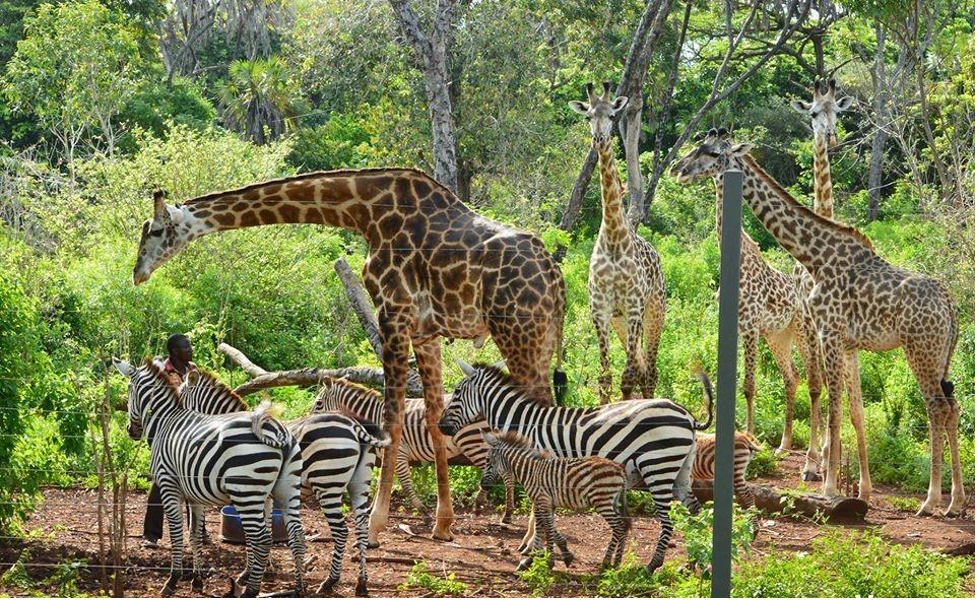
From BoraBora wildlife, we will continue riding north to conservation for colobus headquarters, where will be able to see a variety of species. The famous Angolan black and white colobus is present here. It has been listed as vulnerable to extinction by the International Union for Conservation of Nature (IUCN). In support of the organization’s conservation’s efforts, there are different support and donation packages in place, which you may be interested in taking part.
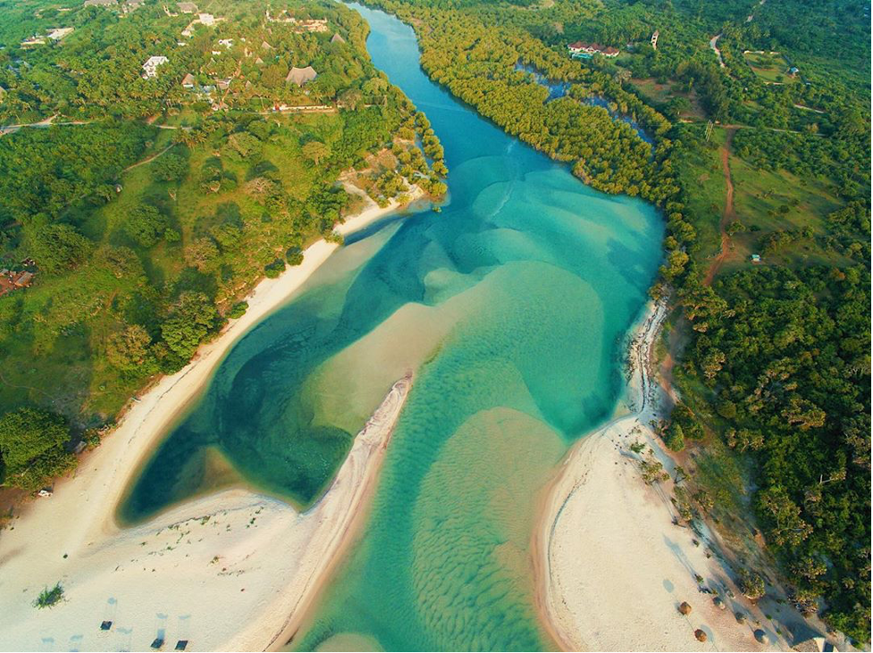
From there, we will go get something to eat as early lunch, before proceeding. The Coast dishes Hotel in Diani will be the location. They have great food, both local and foreign, which you’ll need to try on your last day of the adventure. Afterwards, will ride to Kongo River along Diani beaches, one of the most beautiful beaches in Africa. It is one of the main rivers feeding its water into the Indian Ocean, the Kongo River. It is one of the kind in the south Coast, with its origins rooted in Shimba Hills. The estuary is beautiful, providing an excellent sandy beach good for relaxation.
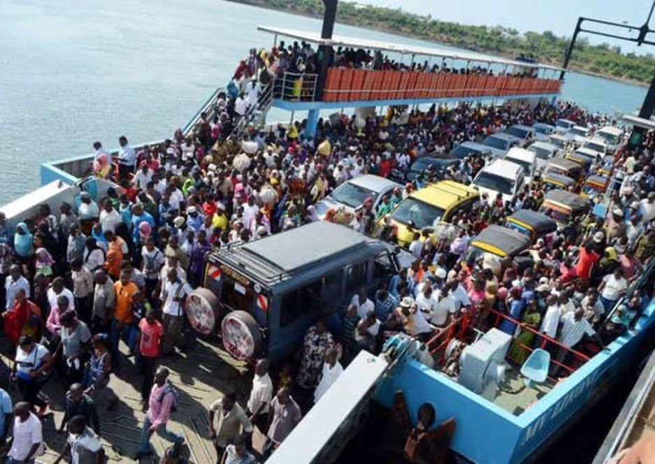
After a wash and probably a swim in the clear waters of Kongo River, we will hop on our bikes again and head to Mombasa, a distance of about 50 kilometers. We will cross over to the Island via a ferry, operated by Kenya Ferry Services. You will be experience the rush hour hustle experienced at the ferry station, between vehicles, motorcycles and people who are always in a hurry to cross over to either sides.
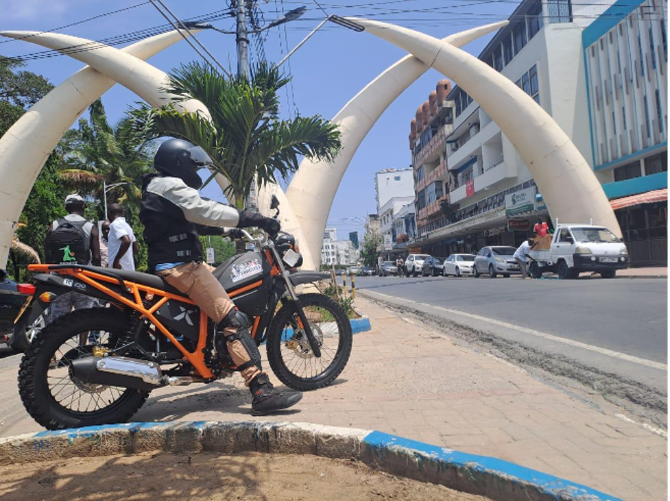
From the ferry, we will ride to our offices in Mombasa, through Mombasa town CBD. We will pass through Pembe za Ndovu, one of the unique features of the city of Mombasa. We will take a group photo while standing at the location, marking the end of our five day tour. After a photoshoot, we will drop the bikes off at AMT Motorcycles offices in Nyali, Mombasa.
This tour is among the best routes for bikers, and those who want to spend a better part of their week crisscrossing Southern Kenya and experiencing the local way of life while riding motorcycles.
NOTE: The hotel reservations are subject to change based on availability.
Tour coast: $1700 (Inclusive of meals, accommodation, and gas and park entry fees.) Excludes tips, drinks and donations).
Special Discounts
When in groups, a special discount on the total tour cost will be given as follows:
A group of two, three and four – 10% discount
A group of more than five – 15% discount