Tour Cost: $1200 (Inclusive of meals, accommodation, and gas and park entry fees.) Excludes tips, drinks and donations).
What you will see
During the tour, you’ll be able to see the majestic Ngong hills, sitting on the South West of the city. You’ll also be taken around the Mount Suswa Conservancy where you will see the caves, and the history of rock painting. In hells gate, you will also get the opportunity to see the wonders of the Great Rift Valley, and the wildlife inhabiting the park. A view of Mount Longonot at midday is also great, which you will get to experience. Other important features you will see are Lake Naivasha, one of the rift valley lakes, and the Abadare ranges.
Itinerary
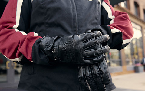
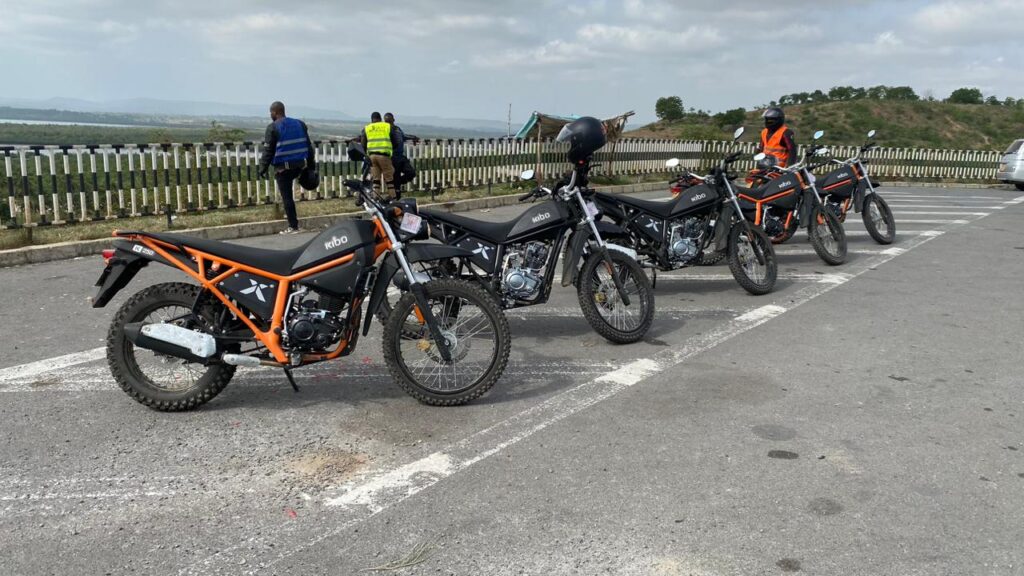
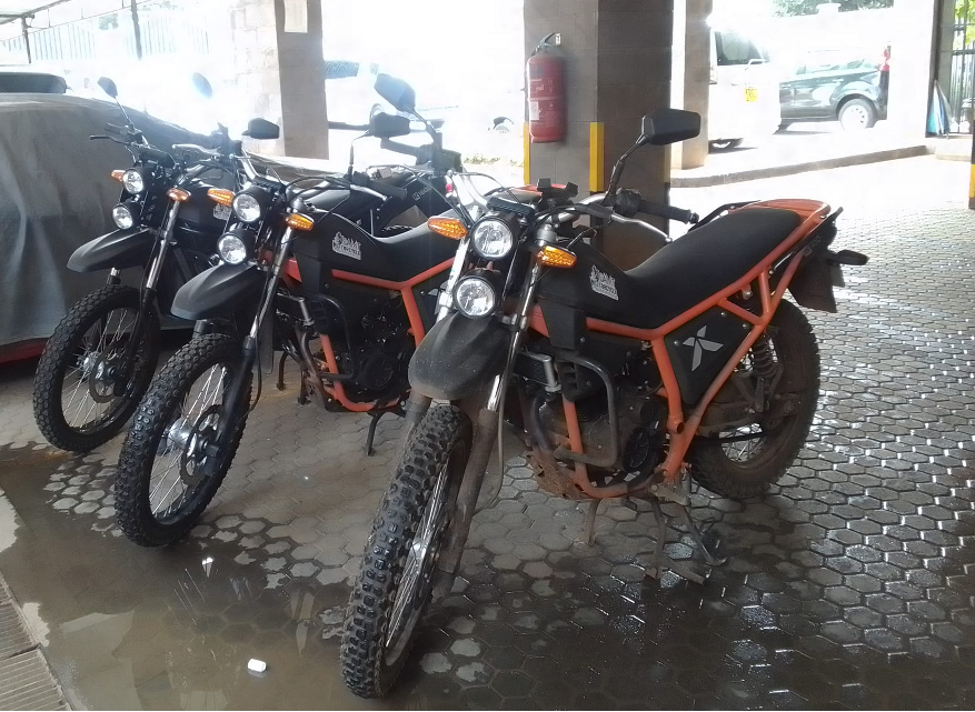
Your arrival at the Procmura building Nairobi will be the first thing for this tour. A few paperwork will be undertaken, where you will be required to complete. You will thereafter take the necessary riding resources essential for the ride. Our guides will give out a few instructions and advice on how to successfully take part in the tour. You will use this opportunity to make sure that your bike is good to go, with possible adjustments here and there.
Our first stop will be the Ngong forest. This is one of the forests close by the city, just a few kilometers away. Due to its proximity, it is an attraction to both the locals and foreigners visiting and living in Nairobi and its neighborhood satellite towns. The forest’s location gives it a unique role in Nairobi and Kenya at large. Being managed by the Kenya forest service, the forest covers an area approximately 1224 square kilometers. Previously, the forest was covering more than 5000 square kilometers and most of its land has been lost through grabbing. The forest has nice motorable trails, which you will get to enjoy and appreciate the ecosystem. The feeling that comes when riding through the serene environment will blow your mind off and take a special place in your exciting memories.
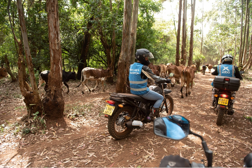
Through the forest on the designated trails, we will make our way to the Ngong hills. While up there, you will be able to see the rest of Ngong town and the city’s skyline on a clear day. Formed on the floor of the Great Rift Valley, Ngong hills are peaks in a ridge located southwest near Nairobi, in southern Kenya. The word “Ngong” is an Anglicization of a Maasai phrase “enkong’u emuny” meaning rhinoceros spring, and this name derives from a spring located near Ngong Town.
At the top of the mountain, wind power is being generated by use of wind turbines, which stand several meters high. The turbines are slowly but constantly turning generating extra megawatts for local consumption. The generation station is owned by KenGen.
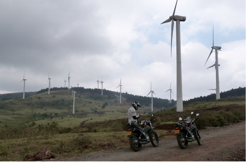
Riding to the top of the hills will allow you a great view of Ngong and the rift valley extending to the south. However, most of the time the weather at the top is cold, requiring you to dress up properly for longer stay.
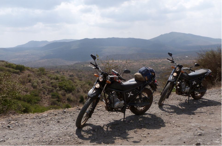
After the breathtaking views of the Ngong forest and hills, we will steadily and enjoyably ride to Suswa, which is located on the West side of Ngong town. The stretch between Ngong, Koimuke junction to Mount Suswa conservancy is a nice off-road with a lot of good challenges and obstacles for an individual that will want an off-road adventure experience. These challenges will require you to unleash your enduro riding skills. For the beginners and intermediates, the stretch will definitely build your confidence and abilities when it comes to off-roading.
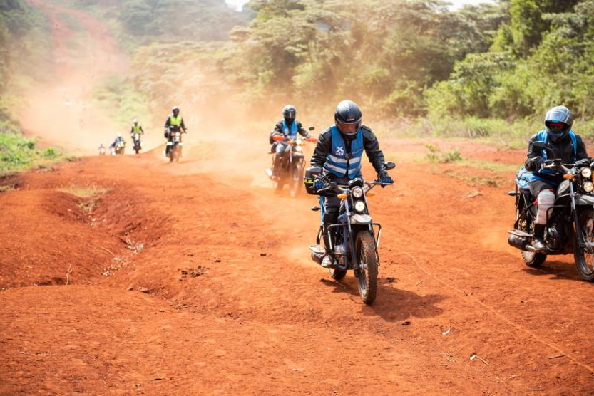
We will be riding for approximately 110 kilometers of dirt road. Among the challenges you will encounter include uneven road terrain, sharp rocks that will require excessive steering, sand and mud patches depending on the season. However, or bikes are made to overcome this obstacles with ease. The front 21 inch off-road kenda tyre is meant to go over anything. The shock absorbers on the other hand are ready to absorb any impact subjected to you bike to ensure a smooth ride all the way.
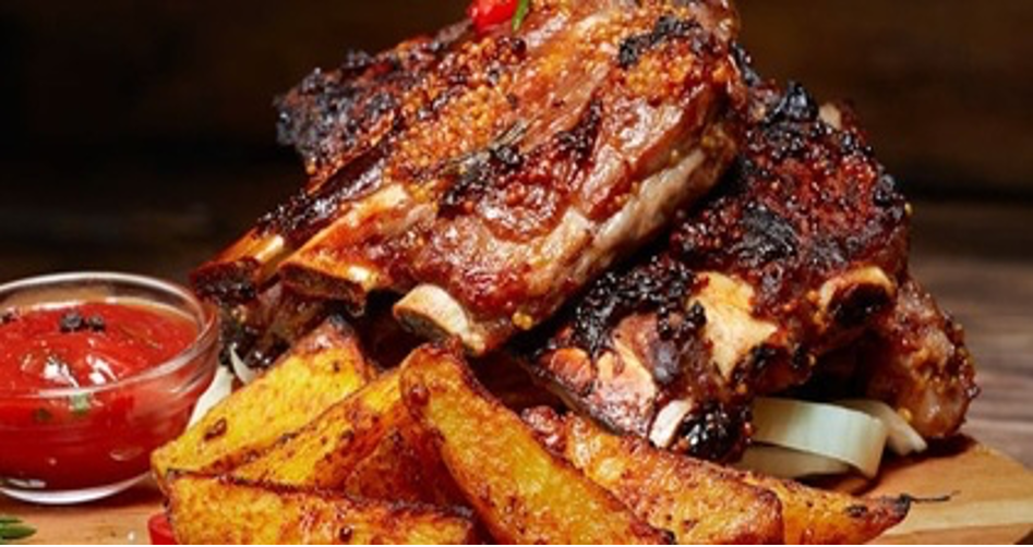
Upon reaching Suswa and enjoying the beautiful views of the landscape, we will collectively partake in having something to eat, to replenish our strength, as we share our experiences of the ride. To make it memorable and unique, African local food will be served, including Nyama Choma (Roasted meat), at Mara Gateway Hotel.
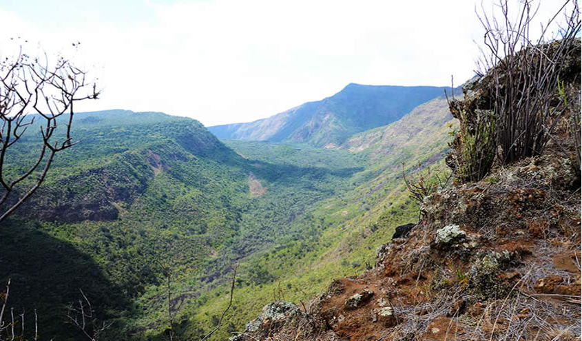
Upon making our stomachs full, it’s time to commence the Mount Suswa Conservancy tour. Mount Suswa is a shield volcano in the Great Rift Valley, Kenya. It’s located between Narok and Nairobi. Mt. Suswa is an underrated gem on the Rift Valley floor. The double-crater shield-volcano promises an unmatched hiking experience and over-delivers on breathtaking views. The highest point on the Mountain is 2355 meters above sea level, with an elevation gain of 679 meters. It is a double crater volcano with a shield shape cone covering an area of about 270km.
The conservancy is entirely run by the Maasai community that there, meaning that all entries and camping fees go towards conservation, not just the park but the lifestyle of residents. The guides on the mountain are well versed and knowledgeable about the mountain conservancy and the efforts that have put in place.
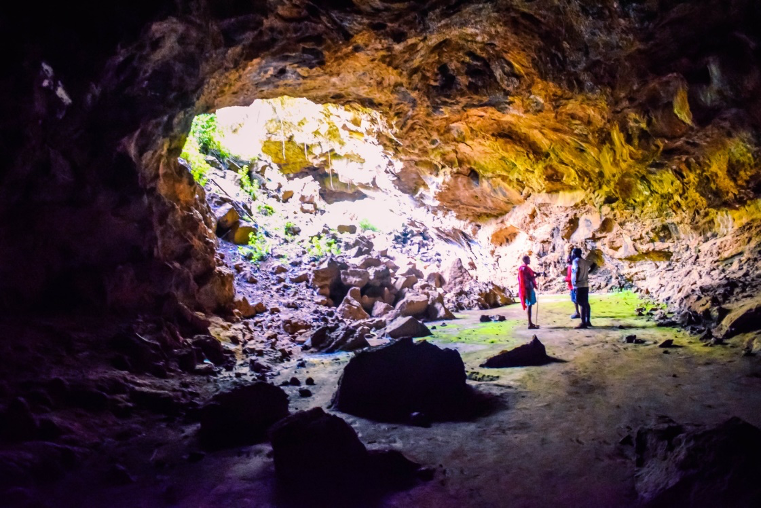
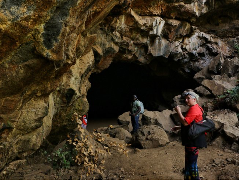
The Suswa caves are home to large population of bats that are said to travel as far as 30km searching for the food at night and then retreat to the caves in the morning. As you walk and crawl through the caves you can view the colonies of bats hanging from the top, asleep and dead to the world until evening when they stream out
There are over 45 entrances most of which are collapsed roofs into this caves. Perhaps the most known attractions at Mount Suswa conservancy are the lava caves on the outer crater. Fig trees and others type of vegetation mark the location of some of the opening. One interesting location in the caves is the baboons’ Parliament where a large troops of baboons take shelter at night from predators. The baboons’ troops’ arrival in the evening coincide with the departure of the local bat colonies, creating two way traffic. It is said that if you peer down the opening in the roof early in the morning and evening you will find the troop leader perched on a pile of rocks at the Centre of the chamber, seemingly addressing the rest of the troop perched on ledges high up the walls of the caves.
Another interesting feature in the caves is a rock painting in one of the Chambers attributed to the locals Maasai morans, who apparently sleep there during one of their initiation rituals.
After finishing the long tour of Mount Suswa conservancy, we will head straight back to Mara Gateway hotel, where we will have dinner and spent the night. A warm shower will definitely be the most important thing, considering the ride from Nairobi and around the Suswa conservancy. After dinner, we will go through our next day activities and how to partake them. Afterwards, you are free to have a few drinks if you wish.
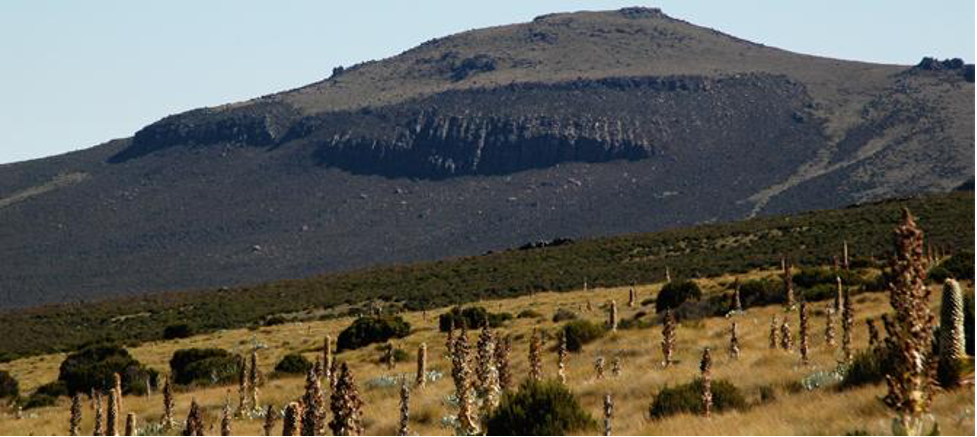
After our breakfast, and ensuring that everyone is set up, we will head to another beautiful destination, the Mount Longonot National Park. Mount Longonot is one of the extinct volcanic mountains in the Rift Valley. It is a unique feature, due to the thick forest that lies within the crater of the mountain. The crater rim also provides beautiful and great scenic views across the beautiful Rift Valley all the way to Lake Naivasha.

The Park’s temperature is moderate, ranging from 20-30 degrees Celsius, with rainfall ranging from 200-700mm annually. The name is derived from a Maasai name oloonong’ot, meaning “mountains of many spurs” or “steep ridges”. Even though it is one of the fascinating parks in Kenya, it turns out to be one of the least visited countrywide.
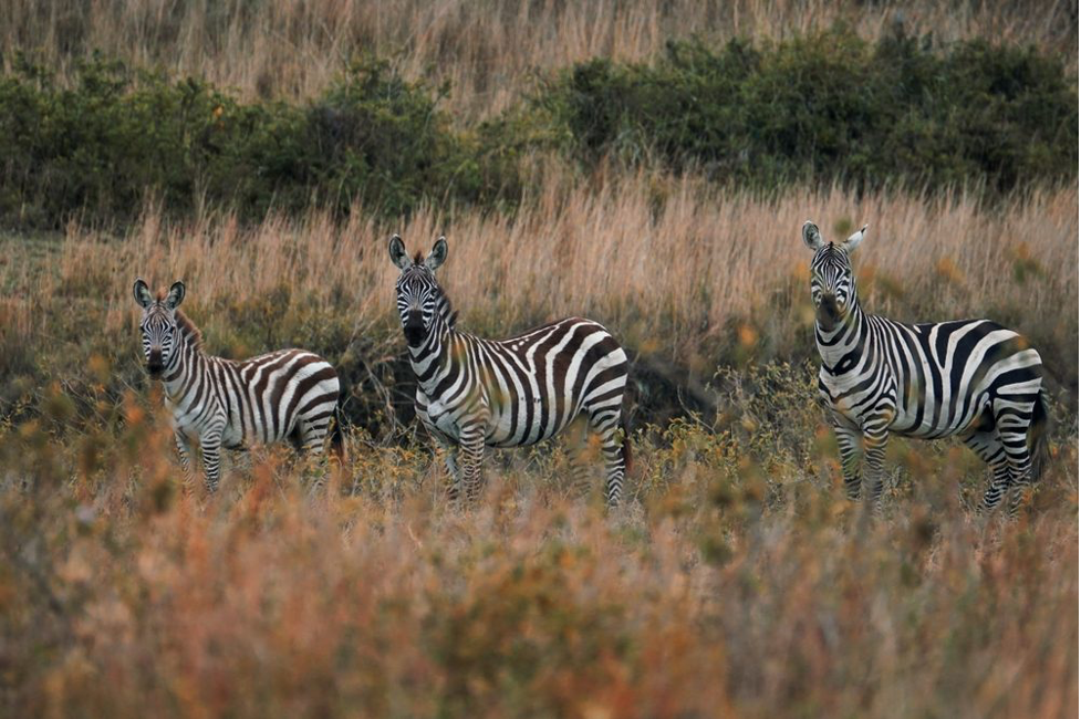
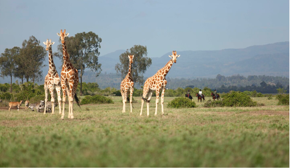
This park is also a rich haven when it comes to wildlife, including bushbucks, common zebra, giraffe and Grant’s gazelles. The presence of these animal has led to activities like bird watching in the area possible.
After catching a few scenery in Mt Longonot, we will ride to Hells Gate where our adventure will continue. Named for the intense geothermal activity within its boundaries, the Hell’s Gate National Park is a remarkable quarter of the Great Rift Valley.
Spectacular scenery including the towering cliffs, water-gouged gorges, stark rock towers, scrub clad volcanoes and belching plumes of geothermal steam make it one of the most atmospheric Parks in Africa. Hell’s Gate is an ideal venue for a day trip, in addition to the bio-diversity that includes raptors, visitors can enjoy mountain biking, rock climbing and a natural spa.
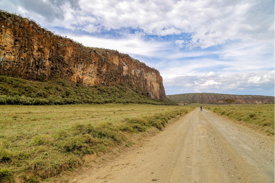


Hell’s gate covers an approximate area of 69 square kilometers. Its elevation is at 1900 meters above the sea level, or 6200 feet. The climate here is warm and dry climate, making it visitable at any given time of the year.
Among the many attraction features here, Olkaria and Hobley’s volcanic features are currently extinct but are visibly spectacular. Additionally, the Hell’s gate Gorge is also eye catching. The red cliffs lining it are beautiful and overwhelms someone’s attention.
The Fischer’s tower on the other hand continue attracting visitors, especially those who like rock climbing, either as a sport or a hobby. Fischer’s Tower is a volcanic plug situated near the northeastern border of the park within a walking distance from Elsa gate, the rock has a height of approximately 25 meters, making it a suitable climbing feature.
A Maasai tale about the Fischer tower is that the tower is a Maasai girl who turned to a stone after looking back on her home, while on the way to her future husband which is contrary to tradition of the community for decades, if not centuries.
Within the park, along the trails you will be able to spot different wildlife, including the zebras, herds of buffalo, hartebeests, elands, Defassa waterbuck, olive baboons, and Maasai giraffe among others. Stopping and glazing at these animals is one of the memorable moments when touring on two wheels.
(Motorcycles are not allowed within Hells Gate. Visitors have three options, hiking, cycling or using a van. We can arrange either of the means, upon request.)
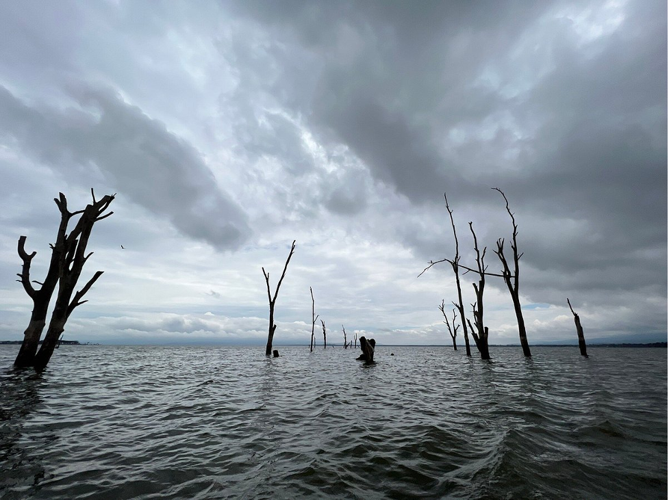
From Hells gate, we will have something to eat, before proceeding to our final location for the day, Lake Naivasha, which is found on the South West of Naivasha town. The lake derives its name from the Maasai word for ‘rough water’ due to the sudden storms that are known to arise in the area. Lake Naivasha is a freshwater lake in Kenya, outside the town of Naivasha in Nakuru County, which lies North West of Nairobi.
It is believed that Lake Naivasha is at the highest point of the rift Valley, at 1884 meters above the sea level. The lake receives its water from various sources, including the perennial Malewa and Gilgil rivers among other streams. The lake does not have an outlet, but its water is fresh. This occurrence therefore makes it to be assumed to have an underground outflow. The lake has an average depth of 6 meters (20 feet), with the deepest area being at Crescent Island, at a maximum depth of 30 meters (98 feet). Njorowa Gorge once formed the lake’s outlet, but it is now high above the lake and forms the entrance to Hell’s Gate National Park. The town of Naivasha (formerly East Nakuru) lies on the north-east edge of the lake.

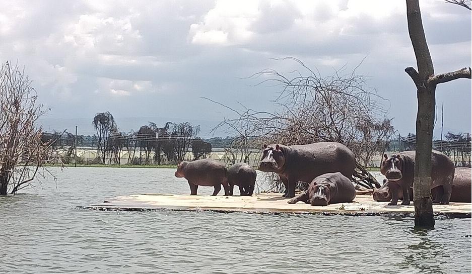
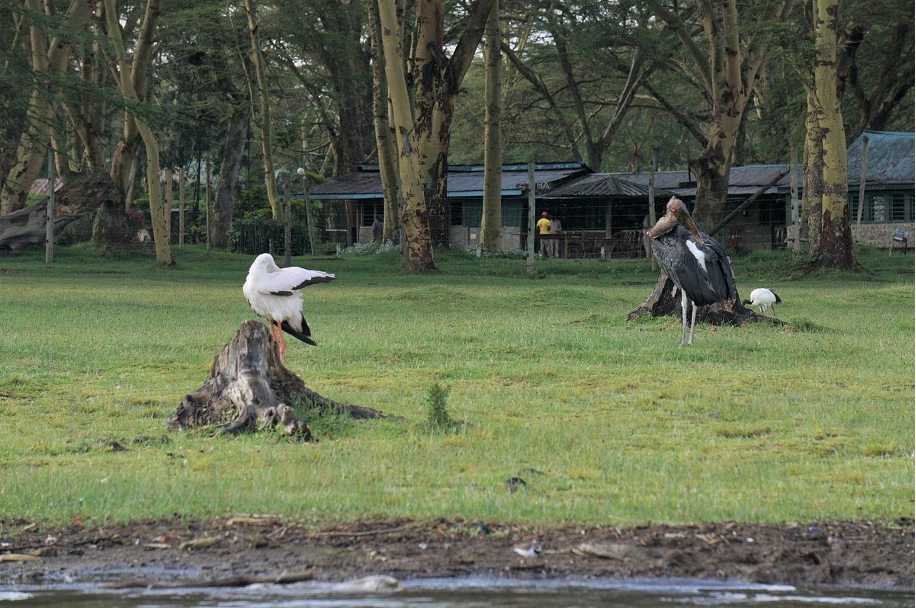

At the Lake, we will board a boat, to go around the lake, and get to experience the waves of the fresh water lake below us. At Lake Naivasha, you will be able to see various species of both flora and fauna. For instance, the lake is surrounded by a swamp, which is estimated to cover approximately 64 square kilometers. However, that depends on the season, because the area increases during the rainy season due to the rise in water levels.
We will be able to see the hippopotamus, which like spending their time close by the swampy areas, surrounding the lake. The number of hippos alone in this location is estimated to be 500. In the past, there were cases of animal and human conflict, which have reduced greatly over the past months.
Apart from the hippos, the water safari will allow you to see the lots of bird species which inhabit the place. There are also giraffes, zebras, buffaloes, elks, and wild beasts, found on the islands, and attracting many visitors, both local and foreign.
After a detailed excursion of Lake Naivasha and its environs, we will ride to our already booked hotel, where we will have a rest for the night.
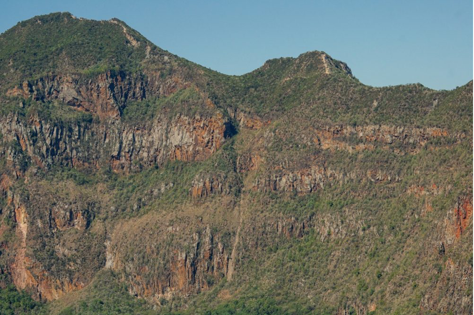
After breakfast, we will head to Aberdare ranges, located north East of Naivasha. Formally the Sattima range, the Abadare range is a mountain range approximately 160 kilometers at an elevation of 3500 meters above sea level. The range straddles across three counties, Nakuru, Kiambu and Laikipia. The mountain range is located in west central, and lies just south of the Equator. The mountain range is called Nyandarua among the Agikuyu people in whose territory this forest and mountain range is located. The name Nyandarua Kenya comes from the Kikuyu word ‘rwandarua’ meaning a drying hide, due to the distinctive fold of its silhouette. The range is heavily forested and provide a water catchment area for most of the rivers in the three counties. The mountain forests are catchment areas for the Tana River, the largest river in Kenya, supplying water to the Seven Forks hydroelectric power complex which generates over 55 percent of Kenya’s total electricity output.

The Aberdare forest ecosystem is made up of rainforest giving way to dense bamboo forests and then moorland. The steep western edges of the hillside are sparsely inhabited by wildlife compared to the forested gentle slopes to the east, which are home to a wide variety of wildlife. There are multitudes of elephant, buffalo, giant forest hog, hyena as well as the endangered black rhino and bongo. A variety of cats including leopards, servals, civet, genet and the rare African golden cat. Other threatened species including the Jackson mongoose, the black and white colobus monkey and Sykes’ monkey are plentiful, as are waterbuck, reedbuck, duikers, and bushbuck.
The Aberdares contain a rich diversity of vegetation. There are 778 vegetation and plant species, subspecies and varieties found in the Aberdare National Park, due to the park’s altitude and rainfall. Hardwood trees include camphor, cedar, podo and hagenia.
Much of the range has been protected within the Aberdare National Park since its creation in 1950. The range attracts large numbers of hikers and climbers operating out of the main centers of Naivasha and Gilgil. The lower slopes are farmed, higher areas are known for their wildlife. The Rhino Charge is an annual event run by conservationists in Kenya to pay for fencing of the Aberdare National Park as a means of protecting East Africa’s largest indigenous forest from destruction. Within the range, we will be able to see the interesting attraction features, including the Karuru falls, which drop for more than 300 meters, and can be seen and heard from far. The Karuru water fall is a unique wonder of the Aberdare range, given its 3 tier or rather steps (staircase) the first tire being 117 meters, then the 2nd 26 meters and the 3rd 130 meters totaling a staggering 275 meters, with only the top tier visible from the viewing point. The spectacular waterfall is nestled right inside one of the most spectacle National Parks in Kenya.
The Aberdare National Park is the place where the princess Elizabeth knew she was going to be a Queen when his father, King George VI passed on. She was staying at Treetops lodge.
From the range, you may be able to spot Lake Naivasha and the Mau escarpment, due to its elevated position. You may also encounter a variety of wildlife which are under the Kenya Forest Service protection. They include the white colobus monkey, elephants, giraffes, antelopes, reedbucks and baboons.
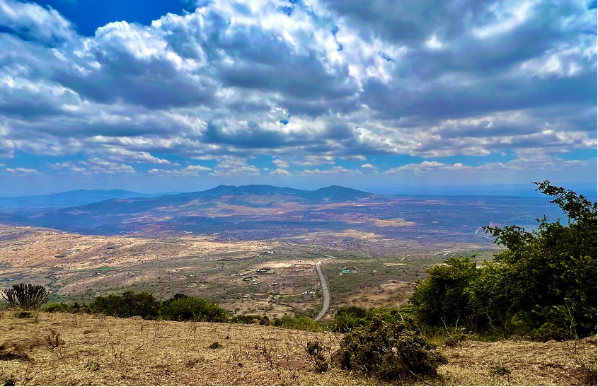
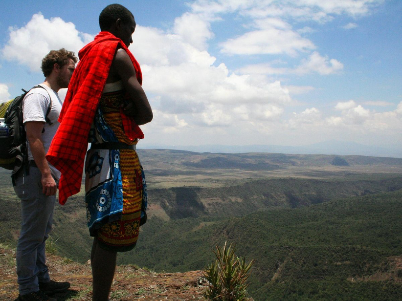
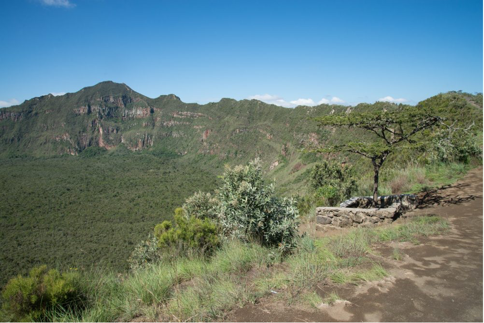
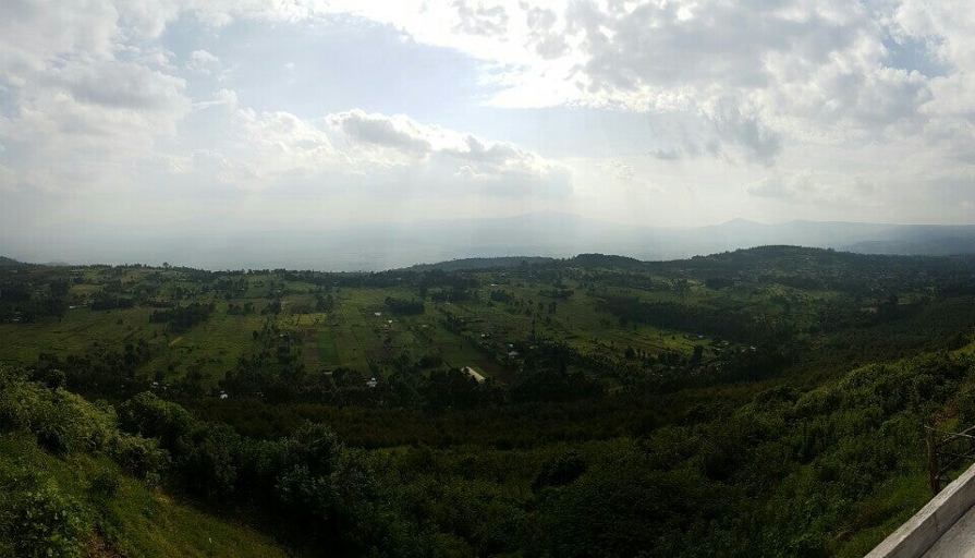
After the Aberdare ranges tour and experience, it will be time to ride back to Nairobi. The return trip will be exclusively on tarmac, allowing you to experience a smooth ride comfortably on your bike. We will stop at Viewpoint (Rift Valley viewpoint, along the busy Nairobi Nakuru highway where we will have one last view of the Rift Valley, marking the end of “the Great Rift Valley Tour.”
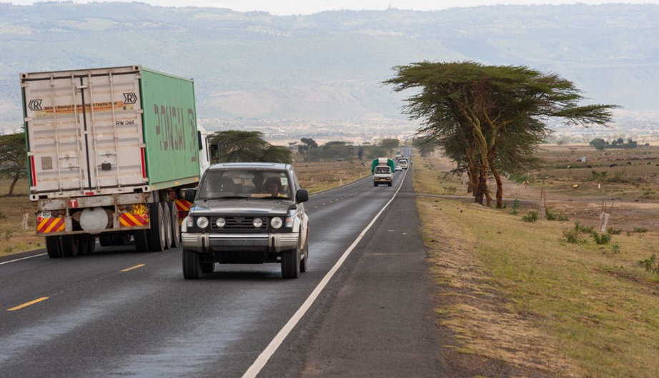
From viewpoint, we’ll head to Nairobi via Limuru, where you will feel a decrease in temperature. The 18 degrees Celsius makes it suitable for farming, especially cabbages, which are primarily grown here. We will ride through the cold weather to Gitaru and then Westlands to AMT Motorcycle adventures Offices at Procmura building. The busy nature of the highway requires that you ride with caution, due to the speeding matatus and trucks plying the route.
Tour Cost: $1200 (Inclusive of meals, accommodation, and gas and park entry fees.) Excludes tips, drinks and donations).