Tour cost: $5000 (Inclusive of meals, accommodation, and gas and park entry fees.) Excludes tips, drinks and donations).
Itinerary
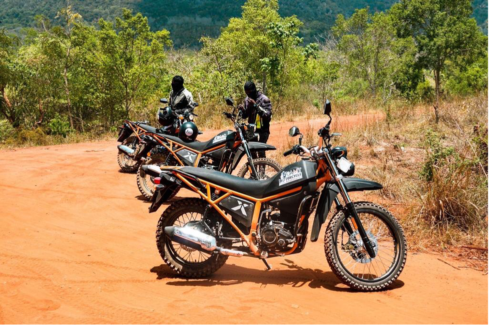
The tour will start at our offices in Westlands Nairobi at around 8am. We will ensure we have everything we need, and also confirm that the bikes are good condition. After a word of instructions from our guides, we will embark on the long adventure around the beautiful country.
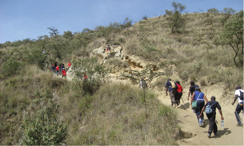
We will ride to Ngong forest, which will be our first stop. Here, you will be able to enjoy the meandering off-road trails that pass through the forest, while enjoying the fresh air from the vast vegetation. It is among one of the few forests close to Nairobi, Kenya’s capital, occupying approximately 1224 hectares. The forest was originally gazette in 1932, and since then, measures have been put in place to conserve it and allow the public to visit and appreciate what it has to offer. The forest is divided into two main sectors by the Ngong Road: the Miotoni Section to the North West, and the Racecourse and Kibera section to the South East.
Through the forest on the designated trails, we will make our way to the Ngong hills. While up there, you will be able to see the rest of Ngong town and the city’s skyline on a clear day. Formed on the floor of the Great Rift Valley, Ngong hills are peaks in a ridge located southwest near Nairobi, in southern Kenya. The word “Ngong” is an Anglicization of a Maasai phrase “enkong’u emuny” meaning rhinoceros spring, and this name derives from a spring located near Ngong Town.
Riding to the top of the hills will allow you a great view of Ngong and the rift valley extending to the south. However, most of the time the weather at the top is cold, requiring you to dress up properly for longer stay.
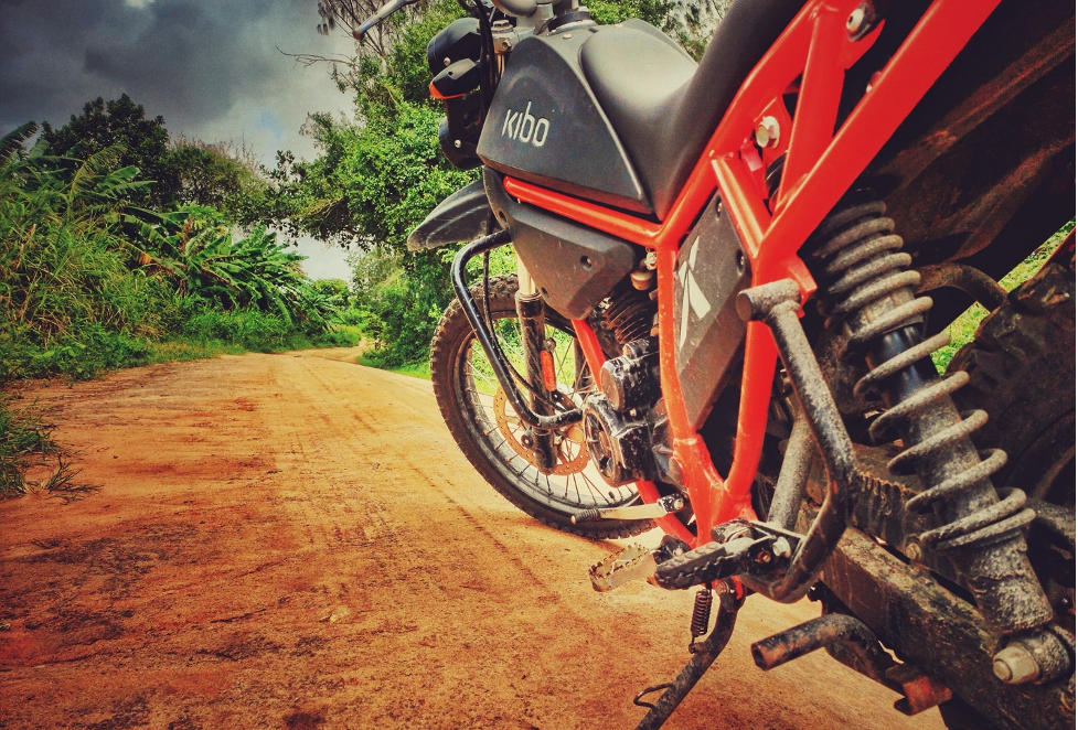
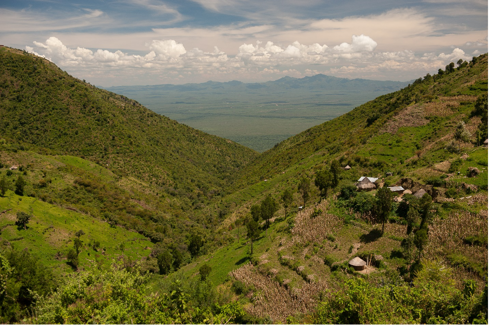
From Ngong hills, we continue riding to Suswa, which is located on the West side of Ngong town. The stretch between Ngong, Koimuke junction to Mount Suswa conservancy is a nice off-road with a lot of good challenges and hurdles for an individual that would create an off-road adventure experience. These challenges will require you to unleash your enduro riding skills. For the beginners and intermediates. The stretch will definitely build your confidence and abilities when it comes to off-roading. We will be riding for approximately 110 kilometers of dirt road. Among the challenges you will encounter include uneven road terrain, sharp rocks that will require excessive steering, sand and mud patches depending on the season. However, or bikes are made to overcome this obstacles with ease. The front 21 inch off-road kenda tyre is meant to go over anything. The shock absorbers on the other hand are ready to absorb any impact subjected to you bike to ensure a smooth ride all the way.
Upon arrival in Suswa, we will first get something to eat, before the mount Suswa conservancy tour. We will have lunch at Mara guest house hotel, where you may try African local food will including Nyama Choma (Roasted meat).
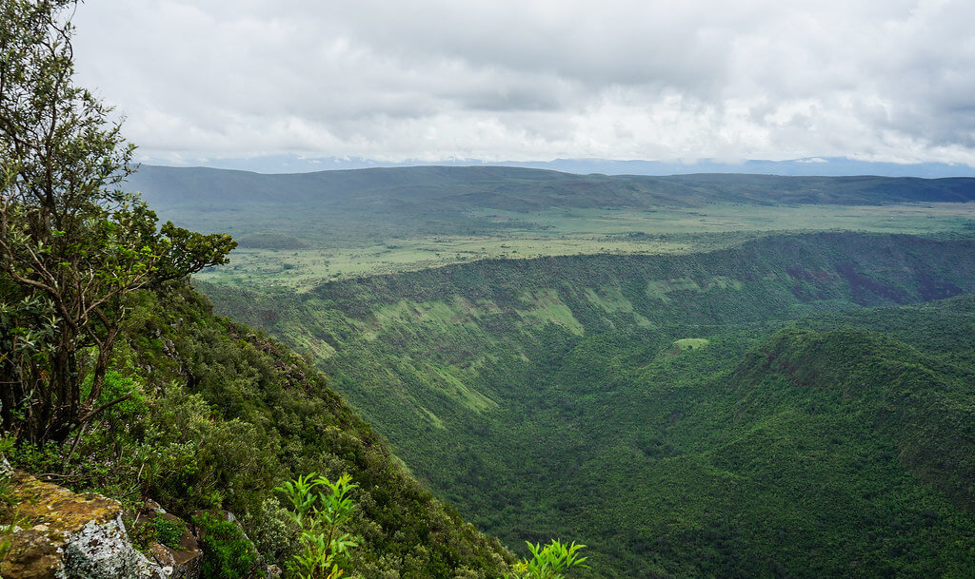
Mount Suswa is a shield volcano in the Great Rift Valley, Kenya. It’s located between Narok and Nairobi. Mt. Suswa is an underrated gem on the Rift Valley floor. The double-crater shield-volcano promises an unmatched hiking experience and over-delivers on breathtaking views. The highest point on the Mountain is 2355 meters above sea level, with an elevation gain of 679 meters. It is a double crater volcano with a shield shape cone covering an area of about 270 square kilometers.
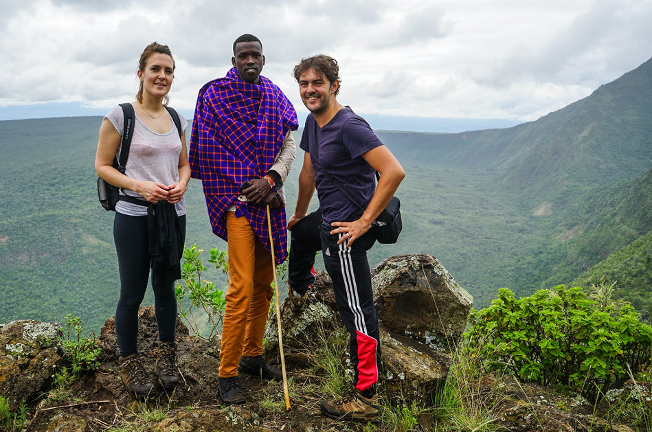
The conservancy is entirely run by the Maasai community that there, meaning that all entries and camping fees go towards conservation, not just the park but the lifestyle of residents. The guides on the mountain are well versed and knowledgeable about the mountain conservancy and the efforts that have put in place.

The Suswa caves are home to large population of bats that are said to travel as far as 30km searching for the food at night and then retreat to the caves in the morning. As you walk and crawl through the caves you can view the colonies of bats hanging from the top, asleep and dead to the world until evening when they stream out
There are over 45 entrances most of which are collapsed roofs into this caves. Perhaps the most known attractions at Mount Suswa conservancy are the lava caves on the outer crater. Fig trees and others type of vegetation mark the location of some of the opening. One interesting location in the caves is the baboons’ Parliament where a large troops of baboons take shelter at night from predators. The baboons’ troops’ arrival in the evening coincide with the departure of the local bat colonies, creating two way traffic. It is said that if you peer down the opening in the roof early in the morning and evening you will find the troop leader perched on a pile of rocks at the Centre of the chamber, seemingly addressing the rest of the troop perched on ledges high up the walls of the caves
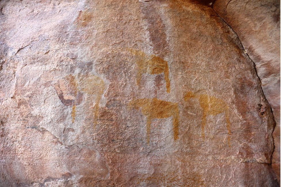

Another interesting feature in the caves is a rock painting in one of the Chambers attributed to the locals Maasai morans, who apparently sleep there during one of their initiation rituals.
After the comprehensive tour of Mount Suswa conservancy, will ride our bikes back to Mara Gateway hotel, where we will spent the night.
Day 2
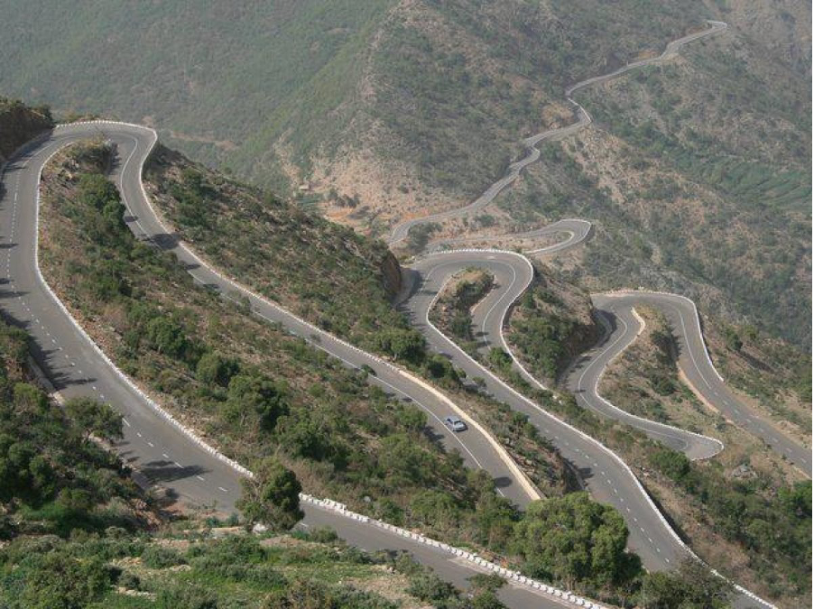
After breakfast, we will ride from the hotel to escarpment. While here, you will be able to see the floor of the rift valley. Since it will be in the morning, the views may be either covered with fog, or clear, illuminated by the rising sunshine. It all depends with the time of the year when taking the trip.

After the lovely views at the view point, we will head north to Mount Longonot. Motorcycles are however not allowed to ride within the Park. We are only allowed to park the bikes before hiking to the top of the mountain. We will pass close by and take a gaze of the mountain from far while on our bikes, before riding to Hells gate. Mount Longonot is one of the extinct volcanic mountains in the Rift Valley. It is a unique feature, due to the thick forest that lies within the crater of the mountain. The crater rim also provides beautiful and great scenic views across the beautiful Rift Valley all the way to Lake Naivasha. The Park’s temperature is moderate, ranging from 20-30 degrees Celsius, with rainfall ranging from 200-700mm annually. The name is derived from a Maasai name oloonong’ot, meaning “mountains of many spurs” or “steep ridges”. Even though it is one of the fascinating parks in Kenya, it turns out to be one of the least visited countrywide.
From the Park, our bodies will be demanding for energy. We will therefore have something to eat for lunch before proceeding.
From mount Longonot, we will head to Hells gate. Named for the intense geothermal activity within its boundaries, the Hell’s Gate National Park is a remarkable quarter of the Great Rift Valley. Spectacular scenery including the towering cliffs, water-gouged gorges, stark rock towers, scrub clad volcanoes and belching plumes of geothermal steam make it one of the most atmospheric Parks in Africa. Hell’s Gate is an ideal venue for a day trip, in addition to the bio-diversity that includes raptors, visitors can enjoy mountain biking, rock climbing and a natural spa.

Among the many attraction features here, Olkaria and Hobley’s volcanic features are currently extinct but are visibly spectacular. Additionally, the Hell’s gate Gorge is also eye catching. The red cliffs lining it are beautiful and overwhelms someone’s attention.
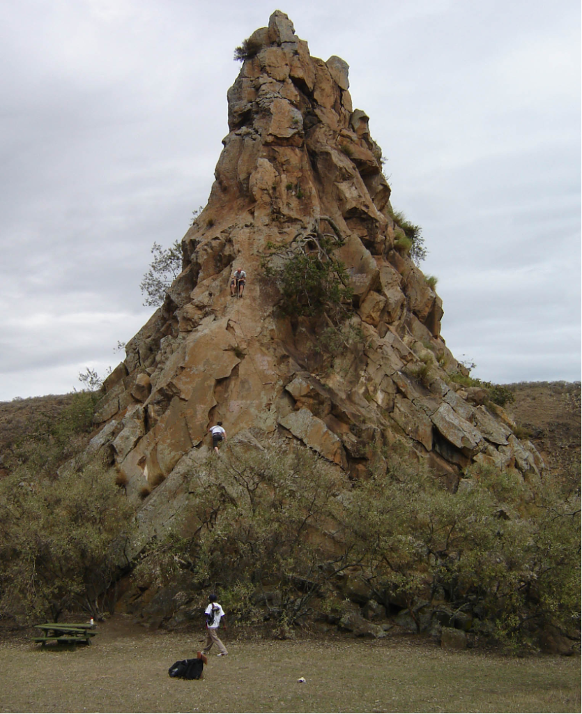
The Fischer’s tower on the other hand continue attracting visitors, especially those who like rock climbing, either as a sport or a hobby. Fischer’s Tower is a volcanic plug situated near the northeastern border of the park within a walking distance from Elsa gate, the rock has a height of approximately 25 meters, making it a suitable climbing feature.
A Maasai tale about the Fischer tower is that the tower is a Maasai girl who turned to a stone after looking back on her home, while on the way to her future husband which is contrary to tradition of the community for decades, if not centuries.
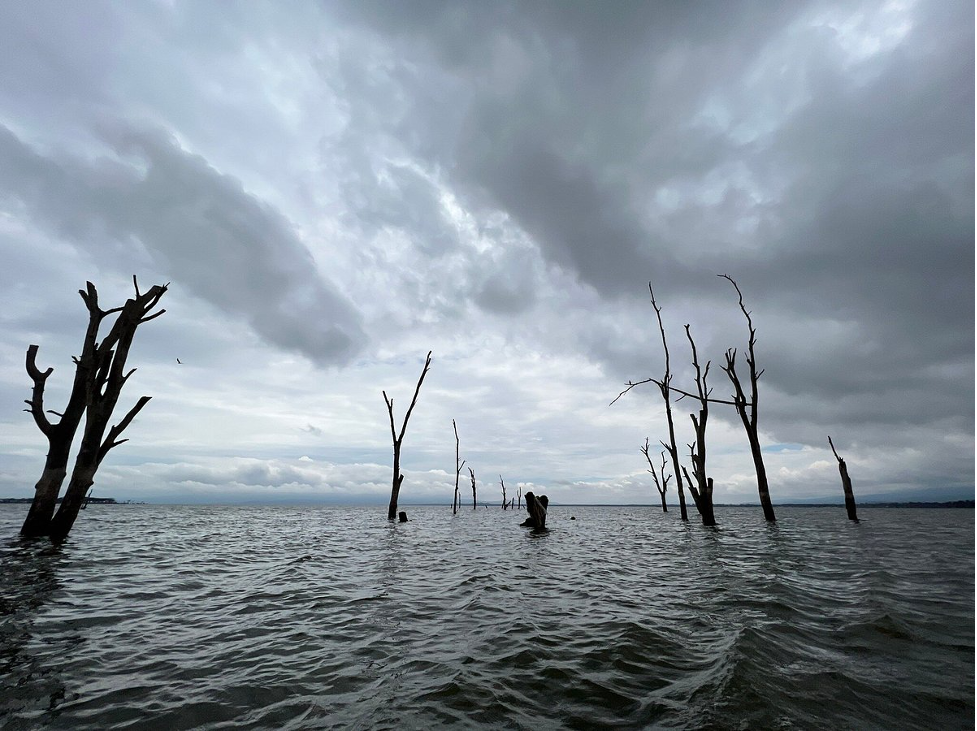
From Hells gate, we will ride to the last location for the day, Lake Naivasha, which is found on the South West of Naivasha town. The lake derives its name from the Maasai word for ‘rough water’ due to the sudden storms that are known to arise in the area. Lake Naivasha is a freshwater lake in Kenya, outside the town of Naivasha in Nakuru County, which lies North West of Nairobi.
It is believed that Lake Naivasha is at the highest point of the rift Valley, at 1884 meters above the sea level. The lake receives its water from various sources, including the perennial Malewa and Gilgil rivers among other streams. The lake does not have an outlet, but its water is fresh. This occurrence therefore makes it to be assumed to have an underground outflow. The lake has an average depth of 6 meters (20 feet), with the deepest area being at Crescent Island, at a maximum depth of 30 meters (98 feet). Njorowa Gorge once formed the lake’s outlet, but it is now high above the lake and forms the entrance to Hell’s Gate National Park. The town of Naivasha (formerly East Nakuru) lies on the north-east edge of the lake.
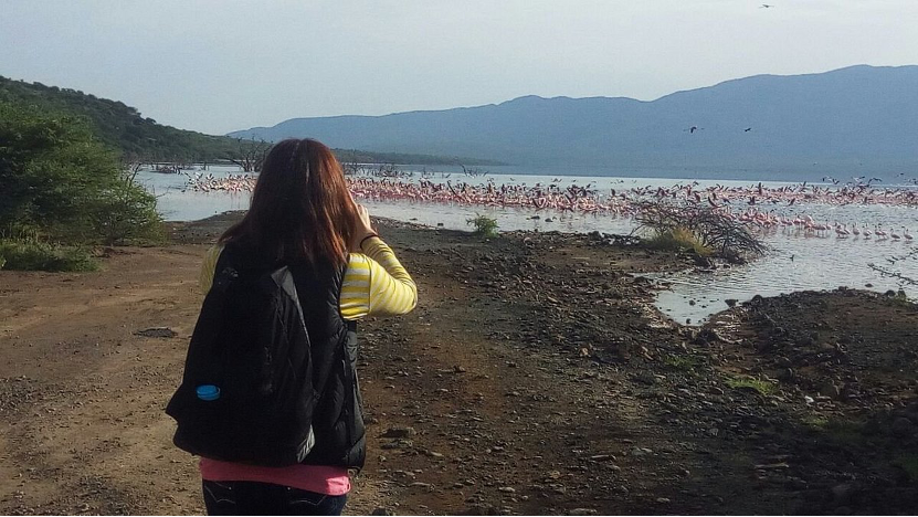
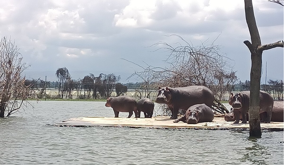
At the Lake, we will board a boat, to go around the lake, and get to experience the waves of the fresh water lake below us. At Lake Naivasha, you will be able to see various species of both flora and fauna. For instance, the lake is surrounded by a swamp, which is estimated to cover approximately 64 square kilometers. However, that depends on the season, because the area increases during the rainy season due to the rise in water levels.
We will see the hippos, which like spending their time close by the swampy areas, surrounding the lake. The number of hippos alone in this location is estimated to be 500. In the past, there were cases of animal and human conflict, which have reduced greatly over the past months.
Apart from the hippos, the water safari will allow you to see the lots of bird species which inhabit the place. There are also giraffes, zebras, buffaloes, elks, and wild beasts, found on the islands, and attracting many visitors, both local and foreign.

After amazing views of Flora and Fauna, and a beautiful boat ride on the lake, we will head straight to our hotel, the Elsueno Homestay where we will spend the night. A warm birth and a good rest will ensure our bodies are fit for the adventures that follow. (Alternative hotels in Naivasha including Tripple Eden Naivasha hotel).

After a good breakfast, the next stop will be Narok. We will ride through the villages, with farmlands covering most of the area. Sections of dirt roads will also make the whole adventure fun. Those who desire to have a countryside riding experience will enjoy these stretches. The beautiful views of unending farmlands are great, considering these are the agricultural baskets of Kenya.
From having the great moves in Narok, we will head to Mara North Conservancy (MNC). It is the largest conservancy in Maasai Mara national reserve and is located on the Northern part of the reserve. Like other national parks and reserves, motorcycles are not allowed within. Upon reaching the conservancy, we will pack our bikes and hope into a van that will take us through the conservancy. The conservancy forms a greater ecosystem and a home for the big cats and other wildlife that are categorized as being leading in tourist attraction. The conservancy was established in 2009, a collaboration between more than 12 member accommodation and more than 800 local Maasai who own the land. The conservancy also boasts to host the big five, including rhinos, elephants, lions and buffaloes.


After a the game drive, we will hop on our bikes and head towards the Mec style Lodge, where we will spend the night before going on with the adventure.
After a good breakfast, we will continue riding South West, to Isebania, which is a border town to Tanzania. We will ride mostly in villages and avoid main roads, giving you an opportunity to understand the rural cultures of Nyanza people. The village routes may change depending on the weather and accessibility. Stopping along the way to appreciate the green landscape as a result of agricultural
Upon arriving in Isibania, we will head to Borderpoint lodge, where we will have our lunch, get a little rest before proceeding to Migori town. Migori, also known as Suna-Migori, is a multi-ethnic municipal town which acts as the capital of Migori County, Kenya. The town is located 63 kilometers south of Kisii town and 22 km north of the Tanzanian border. The Migori Metropolitan area consists of Migori municipality and the adjacent smaller towns. The area has three constituencies, namely Suna East, Suna West and Uriri, with a total population of 393,012 according to the Kenya National Bureau of Statistics-sponsored national census of 2019. A stop in Migori will be necessary, to allow us refuel our machines before proceeding west to Karungu.
From Migori, Karungu will be our next destination. It is a small village town, west of Migori. It is located on the shore above Lake Victoria, near the frontier with Tanzania. Administratively it is in Karungu Location, Karungu Division, and Migori County. The village town was meant to grow into one of the largest ports on Lake Victoria in the 1800s, but did not to see the light of the day, due to the malaria endemic in the area.

At this moment, you will feel like having a boat ride on the lake, but Sindo will be calling us. Therefore a short stop, approximately 30 minutes will do some good, before riding off to Victoria Sands lodge/SelDu Village resort, where we will spent our night. Due to the mosquito problem, carrying yourself a repellant on this trip is advisable, even though all our resting places will be netted.
After breakfast, we will ride north to Rusinga Island. It has an elongated shape approximately 10 miles (16 km) from end to end and 3 miles (5 km) at its widest point, lies in the eastern part of Lake Victoria at the mouth of the Winam Gulf. Part of Kenya, it is linked to Mbit Point on the mainland by a causeway.
Rusinga is widely known for its extraordinarily rich and important fossil beds of extinct Miocene mammals, dated to 18 million years. The island had been only cursorily explored until the Leakey expedition of 1947-1948 began systematic searches and excavations, which have continued sporadically since then. The end of 1948 saw the collection of about 15,000 fossils from the Miocene, including 64 primates called by Louis Leakey “Miocene apes.”
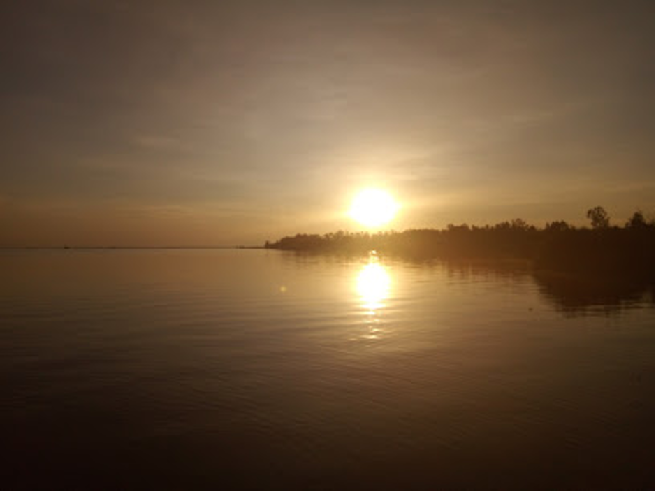
From Rusinga, we will ride to Homabay, where we will have our lunch before proceeding to Kisumu City. The whole 125 kilometer stretch will be on road riding, allowing you to relax and enjoy the views from the highways. We will however take the roads close to the shore, which have great views of the lake. The sun set views over the lake are amazingly pretty. The views from the saddle of your bike are incredibly stunning.
Upon arriving in Kisumu, we will head to the VIP Luxury Lounge hotel, where we will spend the night before proceeding with our adventure. (Alternative hotels Hotels: Family Nest Guest House, Annodas Homes, Milimani)
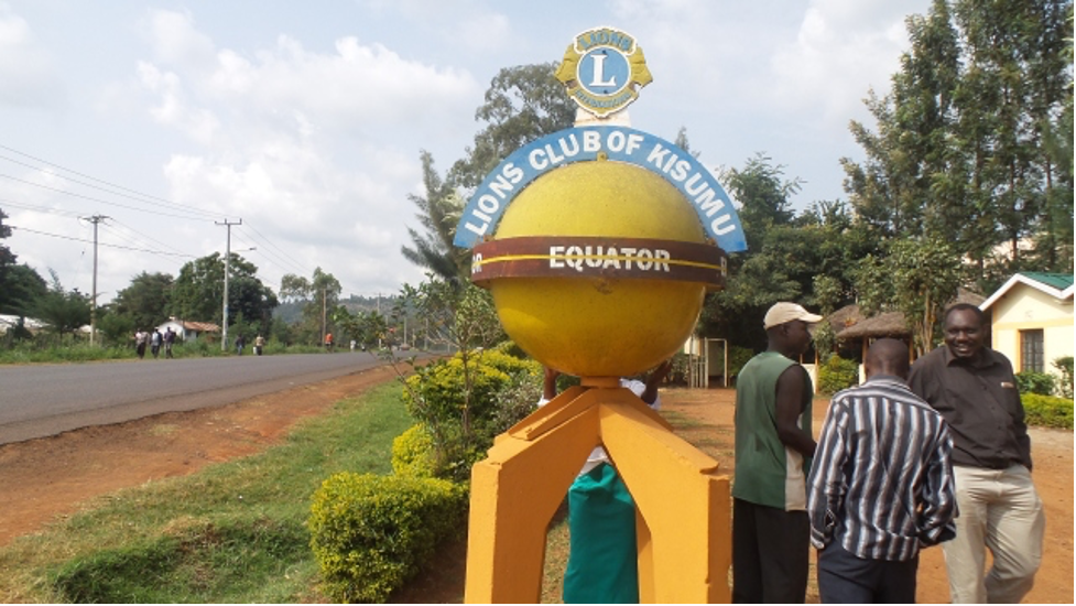
After a whole day of rest, and minor servicing of the bikes to ensure they are in good condition, we will continue with the adventure, north of Kisumu to Maseno. It is a town in Kisumu, the third largest city in Kenya. It is located along Kisumu – Busia highway 25 kilometers to the provincial capital and it is in North West ward. The equator passes through Maseno. Kombewa is located 10 kilometers west of Maseno. The altitude of Maseno is 1503 meters or 4934 feet above sea level.
From Maseno, we will ride to Majengo town via Bunyore. Our next stop will be the crying stone in Kakamega, normally referred to as “ikhonga murwe.” It is located three kilometers outside Kakamega town on a ridge that overlooks the Kisumu-Kakamega highway. The crying stone is about forty meters tall – a large boulder balanced on a column of rock with water flowing from a groove in the center. The strange rock formation resembles a solemn head resting on weary shoulders and, from certain angles, it looks like a person who is crying. However, in recent years, the tracks made by water running down the rock face have been more visible because the Crying Stone of Ilesi is often dry.
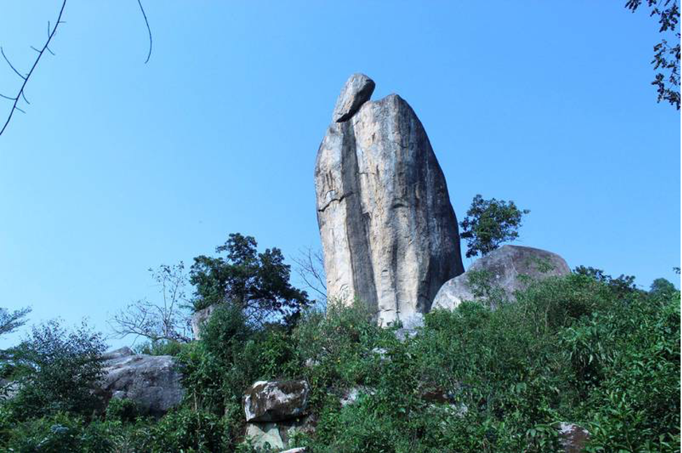
It hasn’t cried continually as it once did for years, and the exact cause is unclear. Some point to agroforestry activities in Ilesi, where eucalyptus trees have been planted in plenty, sucking up large amounts of groundwater. Others blame the effect climate change has had on precipitation levels, something that has led to water sources below and above ground reducing.
Afterwards, we will head to Mount Elgon, through Kimilili and Kapsokwony. It is located north of Kakamega town. We will be riding for approximately two hours before getting to the park. It is one of the national parks in western Kenya. Mount Elgon is an extinct shield volcano on the border of Uganda and Kenya. The mountain’s highest point, named “Wagagai”, is located entirely within Uganda. Although there is no verifiable evidence of its earliest volcanic activity, geologists estimate that Mount Elgon is at least 24 million years old, making it the oldest extinct volcano in East Africa. Its vast form, 80 kilometers (50 mi) in diameter, rises 3070 meters (10070 feet) above the surrounding plains. Its cooler heights offer respite for humans from the hot plains below, and its higher altitudes provide a refuge for flora and fauna. The mountain is the catchment area for the several rivers such as the Suam River, which becomes the Turkwel downstream and drains into Lake Turkana, and the Nzoia River and the Lwakhakha River, which flow to Lake Victoria. The town of Kitale is in the foothills of the mountain. The area around the mountain is protected by two Mount Elgon National Parks, one on each side of the international border.
After great views from Mount Elgon and the surrounding villages, we will ride into Kitale town to the Deepsea resort where we will refresh up, relax and spend the night.
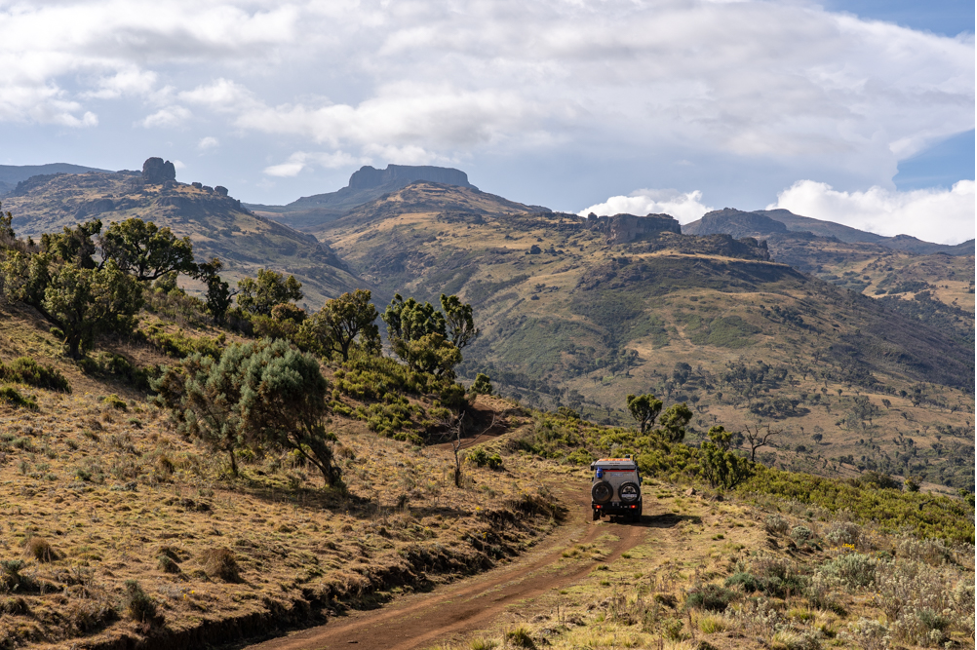
After breakfast, we will head to Iten through Sibanga, Cherengami, Moiben and Sergoit. These are places dominated by farmlands, and small villages and households, spread at a considerable distances from one another. Initially, Kitale and its environs was fully utilized as a scheme, with the main activity being agricultural due to its conducive weather conditions. You will be able to see the famous Cherengani hills, which are a tourist attraction in the region.
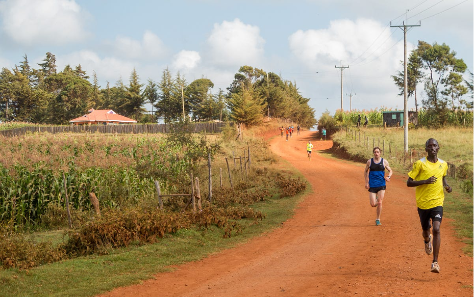
Our next stop will be Iten, a town in Elgeyo Marakwet County. Unlike any other town in the world, Iten is the undisputed capital of Kenyan distance running, a discipline that the country dominates internationally. Kenyan runners won 19 Boston Marathon titles in a 22-year stretch and have posted 10 of the top 11 fastest times ever in the 3,000-meter steeplechase, to give two examples of their unprecedented success at the global level. The village is at the perfect altitude for long-distance training and has miles of hilly dirt roads. This, along with the relative political stability of the area, has attracted elite athletes from all over the country and the world to come train with the champions.
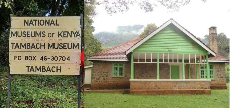
From Iten, we will ride along Rimo game reserve on our way to Tambach. The stretch has viewpoints that capture one’s attention. The views are overwhelmingly amazing. However, despite that, you’ll have to keep your eyes on the road because of the many corners and curves on the road.
We will ride all the way to Kabarnet where we will have lunch before proceeding. Kabarnet is a town in the northern Rift Valley region of Kenya close to Lake Baringo. At an altitude of 1815 meters (5957 feet) Kabarnet is located on the eastern edge of the Kerio Valley, it is approximately 138 km north of Nakuru town on the Nakuru-Marigat-Kabarnet road and 89 km east of Eldoret on the Eldoret-Iten-Kabarnet road. The view of Tugen Hills is spectacular along the road heading west from Marigat. Views include east over the Rift Valley towards Lake Baringo and Lake Bogoria, and west to the Elgeyo escarpment and the Kerio Valley. It is the hometown of Daniel arap Moi, former President of the Republic of Kenya. It is represented in Parliament as part of Baringo Central constituency. His son, Gideon Moi, became the Member of Parliament (MP) from 2003 to 2007, and the only MP in the parliament who went in unopposed in the 2002 general elections that saw the father’s 24-year presidential reign and the ruling party’s 40-year reign come to an end.
Lake Baringo
After a good bite in Kabarnet town, our next stop will be Lake Baringo. It is one of the Kenyan Rift Valley lakes in western central Kenya. It has a surface area of 130 square kilometers (50 square miles) and an elevation of 970 meters (3180 feet). The lake is fed by several rivers: the Molo, Perkerra and Ol Arabel. It has no obvious outlet; the waters are assumed to seep through lake sediments into the faulted volcanic bedrock. It is one of the two freshwater lakes in the Rift Valley in Kenya, the other being Lake Naivasha. The lake is in a remote hot and dusty area with over 470 species of birds, occasionally including migrating flamingos. A Goliath heronry is located on a rocky islet in the lake known as Gibraltar. Lake Baringo has seven fish species with the Nile Tilapia been endemic. Fishing is an important part of the socio-economics of the region. The numbers of Nile Perch have declined markedly in Lake Baringo over the years, but this may have to do with the proliferation of the African Lungfish which was introduced into the lake in the 1970’s. The Lungfish is now the most important food source from the lake. The area is also home to a number of species such as Hippo, Crocodile, Zebra, Klipspringer, Grant’s gazelle, Chandler’s Mountain Reedbuck, and the rare Greater Kudu.

We will also ride around the surrounding villages, before heading to the Sandai Resort hotel where we will spent the night.
After a good breakfast, we will head south of Baringo town to Lake Bogoria. Formerly Lake Hannington, Lake Bogoria is a saline, alkaline lake that lies in a volcanic region in a half-graben basin south of Lake Baringo, Kenya, a little north of the equator. Lake Bogoria, like Lake Nakuru, Lake Elementeita, and Lake Magadi further south in the Rift Valley, and Lake Logipi to the north, is home at times to one of the world’s largest populations of lesser flamingos.

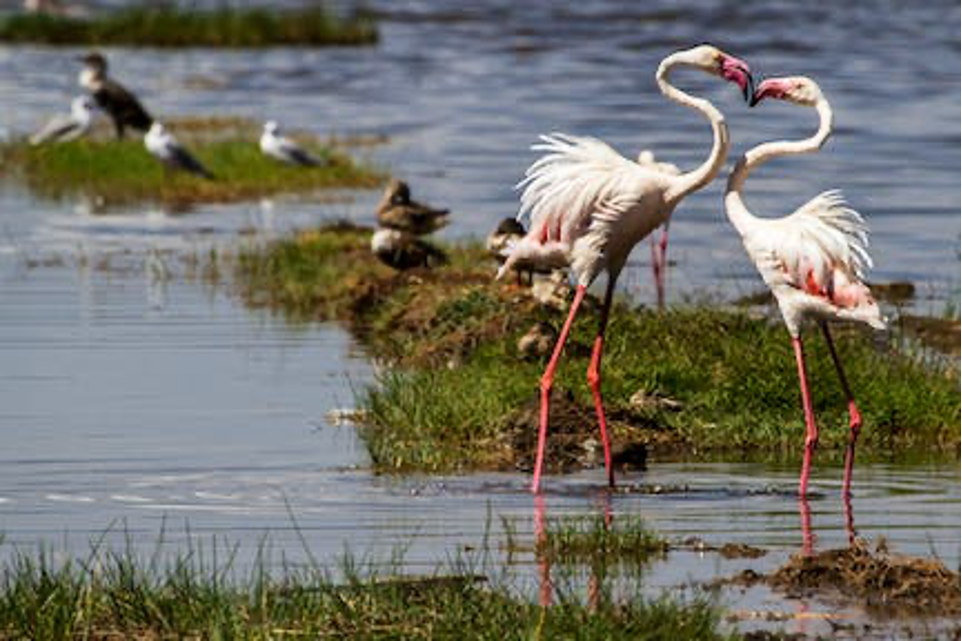
The lake is a Ramsar site and Lake Bogoria National Reserve has been a protected National Reserve since November 29, 1973. It is is shallow (about 10 m depth), and is about 34 km long by 3.5 km wide, with a drainage basin of 700 square kilometers. It is Located in Baringo County. The lake is also famous for geysers and hot springs along the bank of the lake and in the lake. In four locations around the lake can be observed at least 10 geysers with water temperatures from 39 to 98.5 degrees Celsius, which erupt up to 5 m high. Geyser activity is affected by the fluctuations of lake level, which may inundate or expose some geysers.
From Lake Bogoria, we will ride to Rumuruti through Kabel town and Kerandi. The views along the route are so great, a guarantee that you will enjoy the ride all through. We will ride on the Old Rumuruti road that passes through Rumuruti Forest. The temperatures here may be a little low, thus requiring you to have your right riding gear on, to keep warm. In Rumuruti town, we will take our lunch, before proceeding to Nanyuki, riding on the periphery of Ol Pajeta Conservancy.
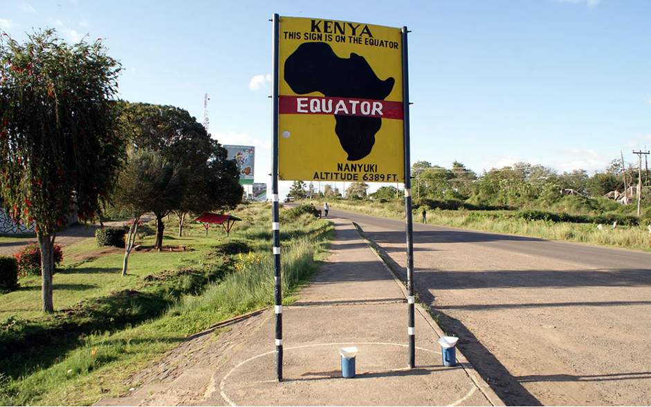
Upon arrival in Nanyuki, we will ride around and experience the town’s culture, including visiting the famous equator line. It is located northwest of Mount Kenya along the A2 road and at the terminus of the branch railway from Nairobi. The name is derived from Enyaanyukie Maasai word for resemblance. It is famous for its farms, ranches, wildlife conservations, and game parks. It sits north of the Equator (0° 01′ North). In 1907, British immigrants settled in Nanyuki, some of whose descendants still live in and around the town. Nanyuki is currently the main airfield (airbase) of the Kenya Air Force. The British Army Training Unit Kenya (BATUK), has a base at Nyati Barracks. It conducts infantry exercises in Laikipia and on Kenyan Ministry of Defense land at Archer’s Post. Nanyuki is also the base for people seeking to climb Mount Kenya.
After a short tour of the town, we will call it a day, and head to the Hotel Taj, where we will spend the night.
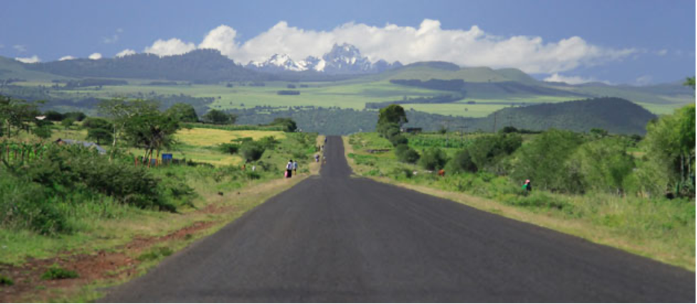
Being our last day of the adventure, we will leave early enough after breakfast. We will ride to Mount Kenya National Park. Motorbikes are however not allowed to exclusively ride within the park, hence keeping them on a few designated trails. At 5,199 m, Mount Kenya is the second highest peak in Africa. It is an ancient extinct volcano, which during its period of activity (3.1-2.6 million years ago) is thought to have risen to 6,500 m. There are 12 remnant glaciers on the mountain, all receding rapidly, and four secondary peaks that sit at the head of the U-shaped glacial valleys. With its rugged glacier-clad summits and forested middle slopes, Mount Kenya is one of the most impressive landscapes in East Africa. The evolution and ecology of its afro-alpine flora provide an outstanding example of ecological and biological processes. Through the Lewa Wildlife Conservancy and Ngare Ndare Forest Reserve, the property also incorporates lower lying scenic foothills and arid habitats of high biodiversity, situated in the ecological transition zone between the mountain ecosystem and the semi-arid savanna grasslands. The area also lies within the traditional migrating route of the African elephant population.

After a few hours of adventure around mount Kenya, we will head, head to Chuka through Meru where we will take our lunch, rest a bit before riding to Nairobi via Embu, Sagana, and Thika. We will be riding on main roads from Mount Kenya, thus you will have a good time of the doing a relaxing ride at an average speed
This whole tour will allow you to experience the beauty of Kenya in 10 days. Riding from one corner of the country to the other on our agile motorcycles, with the help of experienced guides.
Tour cost: $5000 (Inclusive of meals, accommodation, and gas and park entry fees.) Excludes tips, drinks and donations).